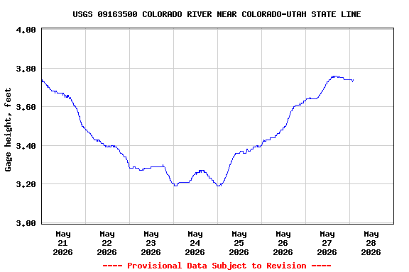
Most recent instantaneous value: 3340 05-28-2026 00:45 MDT
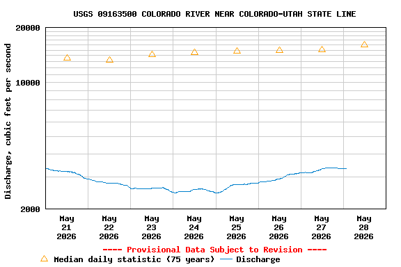
See this graph on the Monitoring Location Pages
| Min (1977) | Most Recent Instantaneous Value May 28 | 25th percen- tile | Median | Mean | 75th percen- tile | Max (1984) |
|---|---|---|---|---|---|---|
| 2220 | 3340 | 9350 | 16000 | 17100 | 22600 | 64600 |