Most recent instantaneous value: 78.0 03-07-2026 19:15 MST
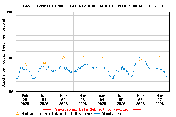
See this graph on the Monitoring Location Pages
| Min (2018) | Most Recent Instantaneous Value Mar 7 | 25th percen- tile | Mean | Median | 75th percen- tile | Max (2007) |
|---|---|---|---|---|---|---|
| 73.9 | 78.0 | 85 | 100 | 100 | 119 | 135 |