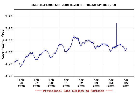
Most recent instantaneous value: 218 03-05-2026 12:00 MST
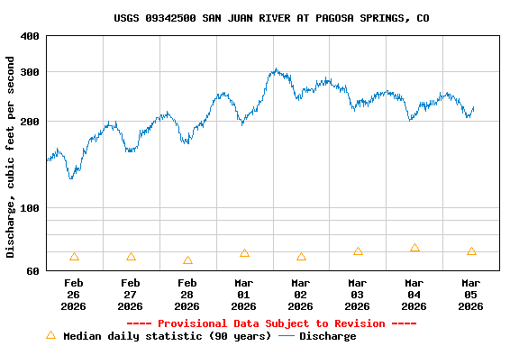
See this graph on the Monitoring Location Pages
| Min (1964) | 25th percen- tile | Median | Mean | 75th percen- tile | Most Recent Instantaneous Value Mar 5 | Max (1986) |
|---|---|---|---|---|---|---|
| 31.0 | 58 | 70 | 90 | 104 | 218 | 494 |