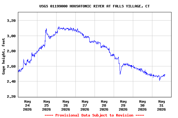
Most recent instantaneous value: 451 05-31-2026 15:15 EDT
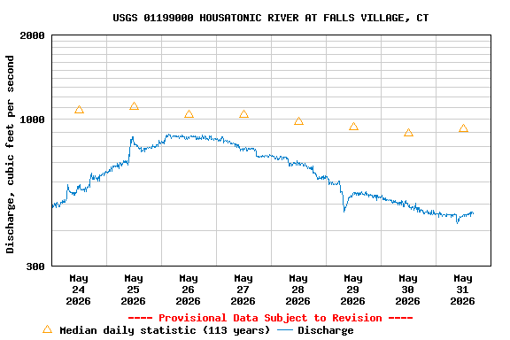
See this graph on the Monitoring Location Pages
| Min (1965) | Most Recent Instantaneous Value May 31 | 25th percen- tile | Median | Mean | 75th percen- tile | Max (1984) |
|---|---|---|---|---|---|---|
| 208 | 451 | 541 | 923 | 1210 | 1300 | 19200 |