LOCATION.--Lat 40°38'25", long 93°48'29"
referenced to North American Datum of 1927, in NE 1/4 SE 1/4 SE 1/4
sec.35, T.68 N., R.26 W., Decatur County, IA, Hydrologic Unit
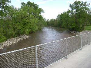
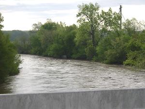
10280102, on right bank 15 ft downstream from bridge on U.S. Highway
69 in Davis City, 3.1 mi upstream from Dickersons Branch, and 5.8 mi
upstream from Iowa-Missouri state line. (map)
DRAINAGE AREA.--701 mi2.
SURFACE-WATER RECORDS
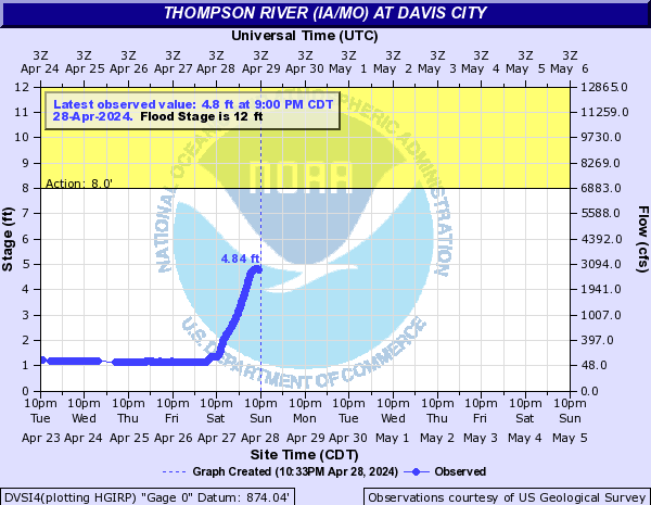
PERIOD OF RECORD.--Discharge records from May 1918 to July 1925,
July 1941 to current year. Prior to October 1918, published as
"Grand River." May 1918 to July 1925, monthly mean
discharge for some periods published in WSP 1310.
REVISED RECORDS.--WSP 1240: 1918, 1920-21 (M), 1922-24, 1925 (M),
1946-47 (M). WSP 1440: Drainage area. WSP 1710: 1957.
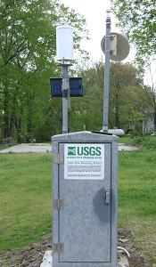
GAGE.--Water-stage recorder. Datum of gage is 874.04 ft above
National Geodetic Vertical Datum of 1929. May 14, 1918, to July 2,
1925, and July 14, 1941, to February 24, 1942, non-recording gage at
same site at datum 2.00 ft higher; February 25, 1942, to February 8,
1967, water-stage recorder at same site at datum 2.00 ft higher.
WATER-QUALITY RECORDS
PERIOD OF RECORD.--Water years 1968-1973.
PERIOD OF DAILY RECORD.--
SPECIFIC CONDUCTANCE: Daily instantaneous values collected in
conjunction with suspended-sediment samples, October 1968 to
September 1973, records fragmentary.
WATER TEMPERATURE: Daily instantaneous values collected in
conjunction with suspended-sediment samples, April 1968 to September
1973, records fragmentary.
SUSPENDED-SEDIMENT CONCENTRATION AND DISCHARGE: May 1949 to June
1954, April 1968 to September 1973. Prior to April 1968,
suspended-sediment discharge records only, provided by U.S. Army
Corps of Engineers.
 Site Information