PROVISIONAL DATA SUBJECT TO REVISION
Click to hidestation-specific text
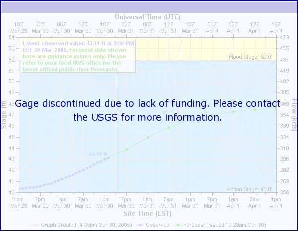
 National Weather Service River
Forecast
National Weather Service River
Forecast
Funding For This Site Provided By:
NOTE: Due to loss of funding from partner organization, operations at this site will be discontinued on July 1, 2016. For more information, email jfnania@usgs.gov.
![]()
![]()
![]()
Summary of all available data for this site
Instantaneous-data availability statement