LOCATION.--Lat 43° 31'02", long 114° 19'18" (NAD83), in SW1/4 NE1/4 SW1/4 sec.9,
T.2 N., R.18 E., Blaine County, Hailey quad., Hydrologic Unit 17040219,
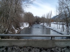
on left bank 15 ft upstream from county road crossing, 0.2 mi southwest
of Hailey, 0.4 mi upstream from Croy Creek, and at mile 91.0.
DRAINAGE AREA.--640 mi2, approximately. Mean elevation, 7,620 ft.
PERIOD OF RECORD.--July to December 1889, June 1915 to September 2006 (see
station 13139510 "Big Wood River at Hailey, ID Total Flow" for data and
statistics after September 2006. At that time, site-ID for current site
was change to 13139510). Published as "Wood River at Hailey" in 1889.
Previously published as 13139510 "Big Wood River and Big Wood Slough combined
discharge at Hailey, Idaho".
REVISED RECORDS.--WDR ID-81-1: 1974-80 average discharge.
GAGE.--Datum of gage is 5,295.42 ft above NGVD of 1929. July to December 1889,
nonrecording gage at nearby site at different datum. June 11, 1915 to Nov. 15,
1934, nonrecording gages at present site at different datum. Nov. 16, 1934 to
Oct. 15, 1970, at datum 2.00 ft higher. Nov. 10, 1971 to Sept. 30, 1972,
nonrecording gages at different sites at present datum.
REMARKS.--Diversions above station for irrigation of about 10,000 acres (1966
determination), of which about 1,200 acres are below station. Storage above
station is negligible.
EXTREMES FOR PERIOD OF RECORD.--Maximum discharge, 7,800 ft3/s May 21, 2006,
gage height, 7.92 ft; maximum gage height, 10.66 ft, June 12, 1921, present datum;
minimum daily, 15 ft3/s Dec. 27, 1931.