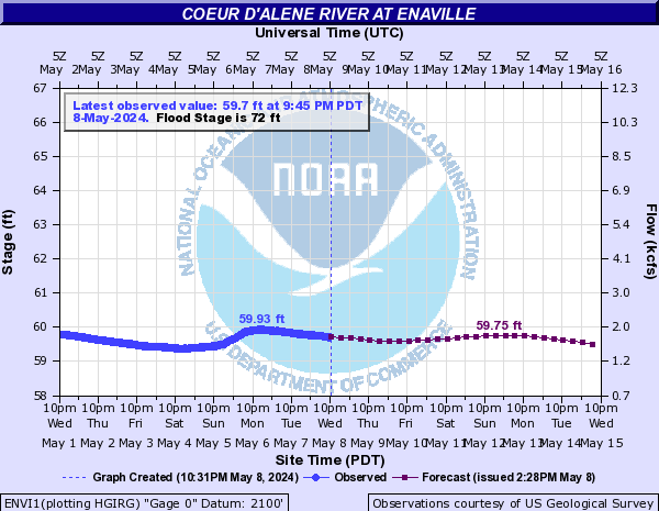
PROVISIONAL DATA SUBJECT TO REVISION
Click to hidestation-specific text

Station operated in cooperation with U.S. Army Corps of Engineers, Shoshone County, and the U.S. Environmental Protection Agency (EPA) with additional funding provided by the U.S. Geological Survey Groundwater and Streamflow Information Program (GWSIP).
Summary of all available data for this site
Instantaneous-data availability statement
 NWS River Forecasts


