USGS 13247500 PAYETTE RIVER NR HORSESHOE BEND ID

PROVISIONAL DATA SUBJECT TO REVISION

Click to hidestation-specific text
Payette River near Horseshoe Bend, ID - USGS file photo USGS Idaho Water Science Center celebrating more than 100 Years of streamgage Records

> Rating Information

> NWS River Forecasts

> Boating Safety

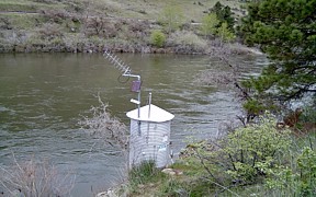
Station operated in cooperation with U.S. Bureau of Reclamation and Idaho Department of Water Resources.

Realtime Gage Height data is provided by U.S. Bureau of Reclamation (USBR) telemetry .

This station managed by the Boise Field Office.

Available Parameters Available Period
  
1986-12-13  2024-04-24
2007-10-01  2024-04-24


 (7)
 

  -- or --


Summary of all available data for this site
Instantaneous-data availability statement


Discharge, cubic feet per second

Most recent instantaneous value: 5150 04-24-2024   01:30 MDT
Graph of  Discharge, cubic feet per second

Add up to 2 more sites and replot for "Discharge, cubic feet per second"

?


Create presentation-quality / stand-alone graph.   Subscribe to WaterAlert      

See this graph on the Monitoring Location Pages


Daily discharge, cubic feet per second -- statistics for Apr 24 based on 114 water years of record more
Min
(2001)
25th
percen-
tile
Most Recent
Instantaneous
Value Apr 24
Median Mean 75th
percen-
tile
Max
(1936)
1680 3360 5150 5560 6150 8060 17400


Gage height, feet

Most recent instantaneous value: 7.51 04-24-2024   01:30 MDT
Graph of  Gage height, feet

Add up to 2 more sites and replot for "Gage height, feet"

?


Create presentation-quality / stand-alone graph.   Subscribe to WaterAlert      

See this graph on the Monitoring Location Pages