PROVISIONAL DATA SUBJECT TO REVISION
Click to hidestation-specific text
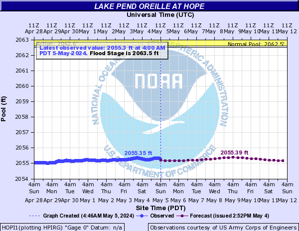
Observed and forecasted lake levels, as well as the official
flood stage, are in reference to the NGVD29 Datum. The Flood Stage of
2063.5 feet is equivalent to an elevation on the new FEMA FIRMS of
2067.37 feet.

Archived USGS values are above 2000 ft NGVD 1929, and above 2003.87 ft NAVD88.
Station is operated in cooperation with the U.S. Army Corps of Engineers .
Summary of all available data for this site
Instantaneous-data availability statement