PROVISIONAL DATA SUBJECT TO REVISION
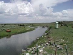
LOCATION.--Lat 44° 17'20", long 111° 53'38" (NAD27), in NE1/4 NE1/4 NE1/4 sec.18,
T.11 N., R.39 E., Clark County, Idmon quad., Hydrologic Unit 17040214,
200 ft upstream from county road bridge, 1.5 mi southeast of intersection
of Red Road and Dubois-Kilgore Road, and 8 mi south of Kilgore.
DRAINAGE AREA.--242 mi2, revised.
PERIOD OF RECORD.--July 1985 to December 1991 (discontinued). Former station,
Camas Creek at Eighteenmile Shearing Corral near Kilgore (sta 13108500), at
site 1 mi upstream, May 1937 to October 1953 (no winter record prior to 1947),
April 1969 to September 1973. Records may not be comparable.
GAGE.--Water-stage recorder. Elevation of gage is 6,220 ft above NGVD of 1929,
from topographic map.
REMARKS.--Diversions above station for irrigation of about 7,500 acres
(1966 determination).
EXTREMES FOR PERIOD OF RECORD.--Maximum daily discharge, 1,400 ft3/s Apr. 23, 1986;
no flow Sept. 5-11, 1991.
Instantaneous-data availability statement