USGS 13237920 MIDDLE FORK PAYETTE RIVER NR CROUCH ID

PROVISIONAL DATA SUBJECT TO REVISION

Click to hidestation-specific text
MF Payette River near Crouch, ID - USGS file photo

> Rating Information

> NWS River Forecasts

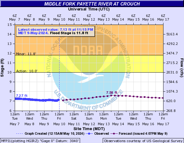
The vertical datum was lowered 5 ft on May 3, 2016 to avoid negative gage heights.

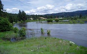
Station is operated in cooperation with the Idaho Department of Water Resources (IDWR) and Water District 65.

This station managed by the Boise Field Office.

Available Parameters Available Period
  
1999-10-01  2024-04-23
2007-10-01  2024-04-23


 (31)
 

  -- or --


Summary of all available data for this site
Instantaneous-data availability statement


Discharge, cubic feet per second

Most recent instantaneous value: 973 04-23-2024   00:30 MDT
Graph of  Discharge, cubic feet per second

Add up to 2 more sites and replot for "Discharge, cubic feet per second"

?


Create presentation-quality / stand-alone graph.   Subscribe to WaterAlert      

See this graph on the Monitoring Location Pages


Gage height, feet

Most recent instantaneous value: 7.78 04-23-2024   00:30 MDT
Graph of  Gage height, feet

Add up to 2 more sites and replot for "Gage height, feet"

?


Create presentation-quality / stand-alone graph.   Subscribe to WaterAlert      

See this graph on the Monitoring Location Pages