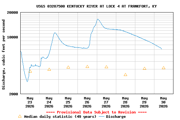
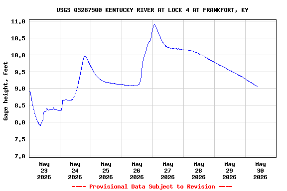
PROVISIONAL DATA SUBJECT TO REVISION
Click to hidestation-specific text
This site is operated in cooperation with the
United States Army Corps of Engineers - Louisville District,
and the
Groundwater and Streamflow Information Program
City of Frankfort,
and
Kentucky River Authority
Gage Datum - 461.58 ft (NAVD 1988)
Gage Datum - 462.1 ft (NGVD 1929)
Boating safety tips
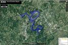
Flood inundation map is available through the USGS Flood Inundation Mapping Science Web site.
United States Army Corps of Engineers - Louisville District,
and the
Groundwater and Streamflow Information Program
City of Frankfort,
and
Kentucky River Authority
Gage Datum - 461.58 ft (NAVD 1988)
Gage Datum - 462.1 ft (NGVD 1929)
Boating safety tips
Flood inundation map is available through the USGS Flood Inundation Mapping Science Web site.
Summary of all available data for this site
Instantaneous-data availability statement