Funding for this site is provided by:
 STATION.
--01601000 WILLS CREEK BELOW HYNDMAN,
PA
LOCATION.--Lat 39`48'43", long
78`43'00", Bedford County, Hydrologic Unit 02070002, on left
bank 150 ft upstream from county highway bridge piers (bridge
dismantled), 150 ft downstream from Pennsylvania RR bridge, 0.4 mi
downstream from Little Wills Creek, and 0.5 mi south of Hyndman.
DRAINAGE AREA.--146 square miles.
PERIOD OF RECORD.--June 1951 to September 1967,
October 1967 to September 1986 (operated as a crest-stage
partial-record station, annual maximum only), October 1982 to September
1991 (occasional low-flow measurements), April 2002 to current
year.
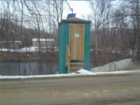
GAGE.--Water-stage recorder and crest-stage gage.
Datum of gage is 893.37 ft above National Geodetic Vertical Datum of
1929 (Pennsylvania Railroad Benchmark).
COOPERATION.--Station established and maintained by
the U.S. Geological Survey. Funding for the operation of this station
is provided by the U.S. Geological Survey.
GAGE HEIGHTS OF IMPORTANCE.-
Supplied by USGS: Data transmitter operational limit -
18.6 ft;
Supplied by NWS: No flood stage has been determined
for this station.

