PROVISIONAL DATA SUBJECT TO REVISION
Click to hidestation-specific text
View the Storm
Summary TimeLapse
|
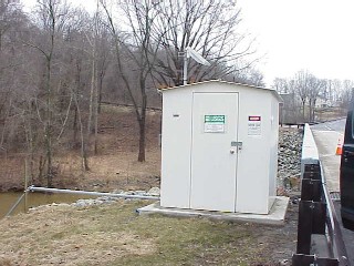 |

LOCATION.--Lat 39°45'46.1", long 75°38'11.4", New Castle County, DE, Hydrologic Unit 02040205,
   on right bank 12 ft upstream from bridge on State Highway 48, 0.3 mi south of Wooddale, 2.3 mi north
   of Marshallton, and 4.9 mi upstream from mouth.
DRAINAGE AREA.--47.0 mi2.
PERIOD OF RECORD.--April 1943 to current year.
REVISIONS HISTORY.-- WSP 1141: 1948. WSP 1272: 1951(m). WSP 1432: 1944(M), 1945, 1946(M), 1948, 1949(M).
   WSP 2102: 1960(M), 1964(M), 1966-67(M). WDR MD-DE-DC-04-1: 2003 (P). WRD-US-2012: 2003 (September monthly
   mean).
GAGE.--Water-stage recorder, concrete control, and crest-stage gage. Datum of gage is 80.34 ft above North
   American Vertical Datum of 1988. Prior to Sept. 21, 1950, nonrecording gage at site 10 ft downstream at
   same gage datum.
REMARKS.-- Low flows augmented at times by inflow from Hoopes Reservoir located 1.7 miles upstream from
   gage on unnamed tributary to Red Clay Creek, capacity 2,000,000,000 gal. Water from Brandywine Creek is
   pumped into Hoopes Reservoir and is released into Red Clay Creek during periods of low flow. Water from
   Red Clay Creek is used for municipal supply. U.S. Geological Survey satellite data-collection platform at
   station. Water-quality records for some prior periods have been collected at this location.
EXTREMES FOR PERIOD OF RECORD.--Maximum discharge, 15,600 ft3/s, Sept. 15, 2003, gage height, 17.62 ft;
   minimum discharge, 2.90 ft3/s, Sept. 4, 1966.
COOPERATION.--Funding for the operation of this station is provided by the Delaware Geological Survey
   and the U. S. Geological Survey.
CRITICAL LEVELS.--Action stage: 5.5 ft, Flood stage: 7.0 ft, information provided by the National Weather
   Service.
| Boating safety tips |
Full resolution current video from the site is also available.
- These time-lapse images are considered a proof of concept with no guarantee regarding product up time.
- Time-lapse videos may only be viewed using Chrome, Firefox or Opera browsers. Additional browser support for Safari and Internet Explorer may be added later.
Any use of trade, firm, or product names is for descriptive purposes only and does not imply endorsement by the U.S. Government.
Summary of all available data for this site
Instantaneous-data availability statement

