PROVISIONAL DATA SUBJECT TO REVISION
Click to hidestation-specific text
|
 |
Summary of all available data for this site
Instantaneous-data availability statement
|
|
|
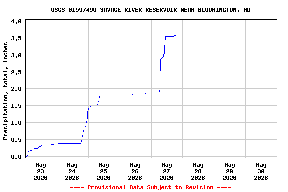
![Graph of Reservoir storage, acre-feet, [Temporary]](https://natwebsdww02.cr.usgs.gov/nwisweb/data/img/USGS.01597490.69824.00054..20260523.20260530..0..gif)
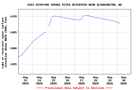
![Graph of Elevation of reservoir water surface above datum, feet, [Temporary]](https://natwebsdww02.cr.usgs.gov/nwisweb/data/img/USGS.01597490.69820.00062..20260523.20260530..0..gif)
![]() U.S. Department of the Interior |
U.S. Geological Survey
U.S. Department of the Interior |
U.S. Geological Survey
Title: USGS Current Conditions for Maryland
URL:
Page Contact Information: Maryland Water Data Support Team
Page Last Modified: 2026-05-30 07:00:44 EDT
4.33 3.48 sdww02