PROVISIONAL DATA SUBJECT TO REVISION
Click to hidestation-specific text
|
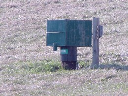 |
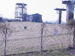
LOCATION.--Lat 39°20'45", long 76°51'25", Hydrologic Unit 02060003, at Granite.
WELL CHARACTERISTICS.--Drilled, unused, water-table well, depth 250 ft; casing diameter 10 in., to 50.7 ft;
   casing diameter 6 in. with depth to 71.3 ft; open hole.
DATUM.--Land-surface datum is 489.48 ft above North American Vertical Datum of 1988
   Measuring point: Top of casing, 1.60 ft above land surface.
PERIOD OF RECORD.--November 1956 to current year.
EXTREMES FOR PERIOD OF RECORD.--Highest water level measured, 13.94 ft below land surface, June 24, 1972;
   lowest measured, 28.20 ft below land surface, Nov. 7, 2002.
REMARKS.--Maryland Groundwater-Level Monitoring Network observation well. U.S. Geological Survey water-level telemeter at well.
   Monthly measurements with electric tape by U.S. Geological Survey personnel.
COOPERATION.--Funding for the operation of this station is provided by the
   Maryland Geological Survey, and the U. S. Geological Survey.
Summary of all available data for this site
Instantaneous-data availability statement