PROVISIONAL DATA SUBJECT TO REVISION
Click to hidestation-specific text
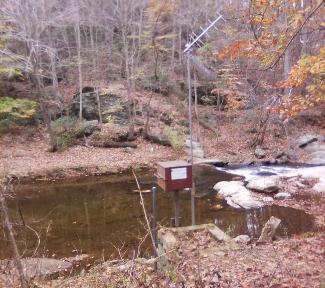
LOCATION.--Lat 39°30'19.3", long 76°25'54.4", Baltimore County, MD, Hydrologic Unit 02060003,
   on right bank 700 ft upstream from Laurel Brook, 750 ft upstream from bridge on Bottom Road,
   5 mi southwest of Bel Air, and 10.5 mi upstream from mouth.
DRAINAGE AREA.--36.1 mi2.
PERIOD OF RECORD.--October 1926 to September 1970, monthly discharge only for some periods,
   published in WSP 1302. Annual maximums only, water years 1971-86. October 1998 to current
   year.
REVISIONS HISTORY--WSP 726: 1927-31, Drainage area. WSP 1502: 1936 (M), 1944-46, 1947-48 (P),
   1949 (M), 1950-51. https://waterdata.usgs.gov/nwis/uv/?site_no=01584500: 2021.
GAGE.--Water-stage recorder and crest-stage gage. Datum of gage is 260.62 ft above North
   American Vertical Datum of 1988, from digital elevation model.
REMARKS.--U.S. Geological Survey satellite data-collection platform at station.
EXTREMES FOR PERIOD OF RECORD.--Maximum discharge, 11,800 ft3/s, July 01, 1984, gage height, 11.40 ft;
   minimum discharge, 1.1 ft3/s, Aug. 21, 2002.
COOPERATION.--Funding for the operation of this station is provided by the Baltimore County Department
   of Environmental Protection & Sustainability, and the U.S. Geological Survey.
Summary of all available data for this site
Instantaneous-data availability statement


