PROVISIONAL DATA SUBJECT TO REVISION
Click to hidestation-specific text
 |
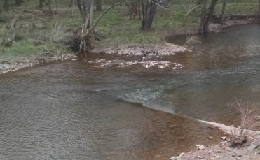 |
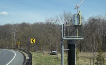
LOCATION.--Lat 39°40'44.6", long 77°14'04.3", Frederick County, MD, Hydrologic Unit 02070009,
   on right bank at downstream side of bridge on State Highway 140 at Bridgeport, 0.9 mi upstream
   from Cattail Branch, 3.4 mi northwest of Taneytown, 4.8 mi downstream from confluence of Rock
   and Marsh Creeks at Pennsylvania-Maryland State line, and 52 mi upstream from mouth.
DRAINAGE AREA.--173 mi2.
PERIOD OF RECORD.--May 1942 to current year.
REVISIONS HISTORY.--WSP 1382: 1944(M).
GAGE.--Water-stage recorder and crest-stage gage. Concrete control since Sept. 15, 1947. Datum of gage
   is 340.18 ft above North American Vertical Datum of 1988. Prior to May 3, 1946, nonrecording gage
   and crest-stage gages at site 0.3 mi downstream at gage datum 0.98 ft lower. July 3, 2012 to April 27, 2016,
   at site 60 ft downstream at present gage datum.
REMARKS.--Occasional regulation at low flow from Lake Heritage and other unknown sources upstream from station.
   U.S. Geological Survey satellite data-collection platform at station. Water-quality records for some prior
   periods have been collected at this location.
EXTREMES FOR PERIOD OF RECORD.--Maximum discharge, 24,400 ft3/s, June 19, 1996, gage height, 25.42 ft;
   minimum discharge, 0.0 ft3/s, July 24-29, 1966.
EXTREMES OUTSIDE PERIOD OF RECORD.--Flood of Aug. 24, 1933, reached a stage of about 25 ft, present site
   and gage datum, from floodmarks, discharge, about 23,000 ft3/s. Stage exceeded that of June 1889,
   from information by local residents.
COOPERATION.--Funding for the operation of this station is provided by Pennsylvania Department of Environmental
   Protection, the Maryland Department of Natural Resources, and the U.S. Geological Survey.
| Boating safety tips |
Summary of all available data for this site
Instantaneous-data availability statement

