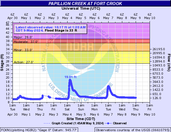
PROVISIONAL DATA SUBJECT TO REVISION
Click to hidestation-specific text
| Funding for this site is provided by | |
 |
|
| Papio-Missouri River Natural Resources District |
National Streamflow Information Program |
 WaterNow – get the latest
gage data from your mobile phone or email.
WaterNow – get the latest
gage data from your mobile phone or email.

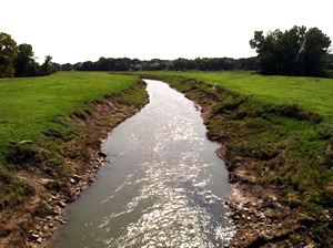
Downstream view near USGS gaging station: Papillion Creek at Fort Crook, Nebr.
|
|
Missouri
River Basin (Niobrara River-Platte River) |
Summary of all available data for this site
Instantaneous-data availability statement

