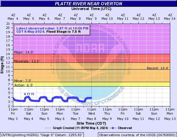
PROVISIONAL DATA SUBJECT TO REVISION
Click to hidestation-specific text
| Funding for this site is provided by | |
 |
|
| Central Nebraska Public Power and Irrigation District |
Cooperative Water Program |
 WaterNow – get the latest
gage data from your mobile phone or email.
WaterNow – get the latest
gage data from your mobile phone or email.

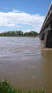
Channel view near USGS
gaging station: Platte River
near Overton, Nebr.
| Platte
River Basin (confluence-Loup River) |
|
Summary of all available data for this site
Instantaneous-data availability statement
![Graph of Discharge, cubic feet per second, [Discharge from Primary Sensor]](https://natwebcaww02.wr.usgs.gov/nwisweb/data/img/USGS.06768000.94480.00060..20240427.20240504.log.0.p50.gif)
![Graph of Gage height, feet, [Primary Stage Sensor]](https://natwebcaww02.wr.usgs.gov/nwisweb/data/img/USGS.06768000.94481.00065..20240427.20240504..0..gif)