USGS 06883530 Little Blue River at County Line nr Deshler, Nebr.

PROVISIONAL DATA SUBJECT TO REVISION

Click to hidestation-specific text
> WaterNow – get the latest gage data from your mobile phone or email.

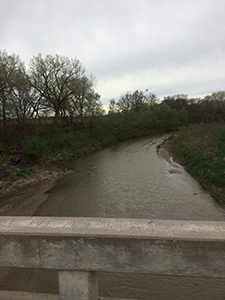
Upstream view near USGS gaging station: Little Blue River at county line near Deshler, Nebr.

Upstream Big Blue River Basin Downstream

This station managed by the Lincoln Field Office.

Available Parameters Available Period
  
2017-04-21  2024-04-18
2017-04-21  2024-04-18


 (7)
 

  -- or --


Summary of all available data for this site
Instantaneous-data availability statement


Discharge, cubic feet per second

Most recent instantaneous value: 49.7 04-18-2024   19:45 CDT
Graph of  Discharge, cubic feet per second

Add up to 2 more sites and replot for "Discharge, cubic feet per second"

?


Create presentation-quality / stand-alone graph.   Subscribe to WaterAlert      

See this graph on the Monitoring Location Pages


Daily discharge, cubic feet per second -- statistics for Apr 18 based on 6 water years of record more
Most Recent
Instantaneous
Value Apr 18
Min
(2023)
25th
percen-
tile
Median Mean 75th
percen-
tile
Max
(2019)
49.7 52.1 58 83 86 116 120


Gage height, feet

Most recent instantaneous value: 5.66 04-18-2024   19:45 CDT
Graph of  Gage height, feet

Add up to 2 more sites and replot for "Gage height, feet"

?


Create presentation-quality / stand-alone graph.   Subscribe to WaterAlert      

See this graph on the Monitoring Location Pages