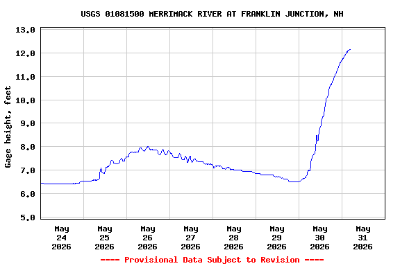
Most recent instantaneous value: 14100 05-31-2026 04:30 EDT
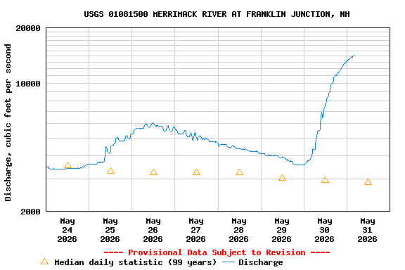
See this graph on the Monitoring Location Pages
| Min (1911) | 25th percen- tile | Median | Mean | 75th percen- tile | Max (1954) | Most Recent Instantaneous Value May 31 |
|---|---|---|---|---|---|---|
| 750 | 1820 | 2860 | 3250 | 4570 | 8060 | 14100 |