PROVISIONAL DATA SUBJECT TO REVISION
Click to hidestation-specific text
 Precipitation Data - see site

Summary of all available data for this site
Instantaneous-data availability statement
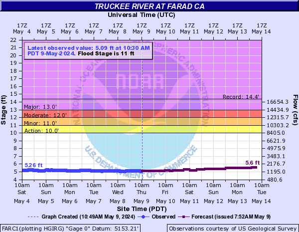
| Most Recent Instantaneous Value Jun 1 | Min (1934) | 25th percen- tile | Median | Mean | 75th percen- tile | Max (1952) |
|---|---|---|---|---|---|---|
| -- unavailable -- | 178 | 738 | 1160 | 1500 | 1890 | 5620 |
![]() U.S. Department of the Interior |
U.S. Geological Survey
U.S. Department of the Interior |
U.S. Geological Survey
Title: USGS Current Conditions for Nevada
URL:
Page Contact Information: California Water Data Support Team
Page Last Modified: 2026-06-01 00:01:34 EDT
3.3 2.81 sdww01