Funding for this site is provided by:
 STATION.
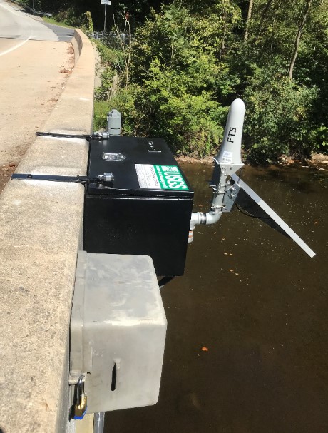
--01575598 CODORUS CREEK NEAR SAGINAW,
PA
LOCATION.--Lat 40`03'08", long
76`39'16", York County, Hydrologic Unit, 02050306, on
downstream side of bridge on Furnace Road over Codorus Creek East
Manchester Township, 0.83 mi upstream from mouth.
DRAINAGE AREA.--277 square miles.
PERIOD OF RECORD.--September 2019 to current
year.
GAGE.--Water-stage recorder and crest-stage gage.
Datum of gage is 253 ft above North American Vertical Datum of 1988.
Satellite telemetry at station.
COOPERATION.--Station established and maintained by
the U.S. Geological Survey in cooperation with the U.S. Environmental
Protection Agency and the County of York.
REMARKS.--Flow regulated by Lake Marburg (01574390)
Indian Rock Dam (01574700), Lake Williams and Lake Redmond; combined
capacity 65,650 acre-ft. Regulation at low flow by mills and pumping
station York Water Company on South Branch Codorus Creek.
Supplied by USGS-- Data transmitter operational limit
- 20.0 ft.

