NOTICE (10/03/2011)--As of October 1,
2011, data collection at this streamgage has been discontinued due to
funding reductions from partner agencies. Although historic data will
remain accessible, no new data will be collected unless one or more new
funding partners are found. Users who can contribute funding for the
non-Federal share of costs to continue operation of this streamgage
should contact Jon Dillow of the USGS Maryland, Delaware, DC, Water
Science Center at 443-498-5524 or email at jjdillow@usgs.gov.
|
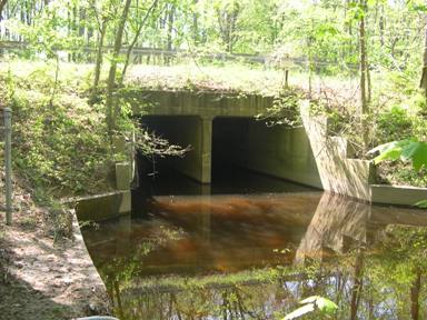 |
LOCATION.--Lat 38°48'41", long 75°58'15", Talbot County, Hydrologic Unit 02060005, on left bank
50 ft upstream from bridge on State Highway 328, 1.0 mi west of Matthews, 1.2 mi upstream from mouth,
and 6.0 mi northeast of Easton.
DRAINAGE AREA.--5.85 mi2.
PERIOD OF RECORD.--July 1950 to September 1981, October 2009 to September 2011 (discontinued).
REVISED RECORDS.--WDR MD-DE-80-1: 1979(M).
GAGE.--Water-stage recorder, crest-stage gage and concrete control. Datum of gage is 2.33 ft above
National Geodetic Vertical Datum of 1929.
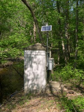
REMARKS.--U.S. Geological Survey satellite data-collection platform at station.
