Warning: Javascript must be enabled to use all the features on this page!


Page Loading - Please Wait...

Click to hideNews Bulletins

USGS 50146073 LAGO DAGUEY ABOVE ANASCO, PR

PROVISIONAL DATA SUBJECT TO REVISION

Click to hidestation-specific text
Click to go to the Departamento de Recursos Naturales y Ambientales web page

Station Drainage Area


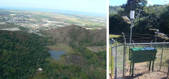
Image of Lago Daguey above Anasco
Aerial photos courtesy of Puerto Rico Energy and Power Authority (PREPA).
This station managed by the Caribbean-Florida WSC - San Juan.

Available Parameters Period of Record
  
2018-06-13  2022-11-15
2004-11-16  2023-01-22
2004-11-16  2024-04-17
2004-11-16  2024-04-17


 (365)
 

  -- or --


Summary of all available data for this site
Instantaneous-data availability statement


Lake or reservoir elevation above local mean sea level (LMSL), feet, [OLDPR]


Graph of DAILY Lake or reservoir elevation above local mean sea level (LMSL), feet, [OLDPR]

Add up to 2 more sites and replot for "Lake or reservoir elevation above local mean sea level (LMSL), feet, [OLDPR]"

?


Create presentation-quality graph.  


Lake or reservoir elevation, above Puerto Rico Datum of 2002, feet


Graph of DAILY Lake or reservoir elevation, above Puerto Rico Datum of 2002, feet

Add up to 2 more sites and replot for "Lake or reservoir elevation, above Puerto Rico Datum of 2002, feet"

?


Create presentation-quality graph.