USGS 01491000 CHOPTANK RIVER NEAR GREENSBORO, MD

PROVISIONAL DATA SUBJECT TO REVISION

Click to hidestation-specific text

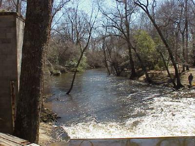
LOCATION.--Lat 38°59'49.9", long 75°47'08.9",
   Caroline County, MD, Hydrologic Unit 02060005, on right bank at highway bridge (removed),
   0.1 mi upstream from Gravelly Branch, 2.0 mi northeast of Greensboro, and 60 mi upstream
   from mouth.
DRAINAGE AREA.--113 mi2.
PERIOD OF RECORD.--January 1948 to current year.
REVISIONS HISTORY.--WSP 1622: 1948. WDR MD-DE-79-1: 1961(P).
GAGE.--Water-stage recorder, concrete control and crest-stage gage.  Datum of gage is 2.73 ft 
   above North American Vertical Datum of 1988.
REMARKS.--Diversions for irrigation of about 500 acres, upstream from station. U.S. Geological
   Survey satellite data-collection platform at station.
EXTREMES FOR PERIOD OF RECORD.--Maximum discharge, 8,880 ft3/s, Aug. 28, 2011,
   gage height, 17.96 ft (from floodmark); minimum discharge, 0.26 ft3/s,  Aug. 19, 20, 2002.
EXTREMES OUTSIDE PERIOD OF RECORD.--Flood in 1935 is believed to have been higher than that of
   Aug. 4, 1967, from information by local residents.
COOPERATION.--Funding for the operation of this station is provided by the Maryland Department 
   of Natural Resources, and the U.S Geological Survey.
This station managed by the MD-DE-DC Water Science Center Dover office.

Available Parameters Available Period
  
2023-04-20  2024-04-18
1990-10-01  2024-04-18
2007-10-01  2024-04-18
2023-04-20  2024-04-18
2023-04-20  2024-04-18
2023-04-20  2024-04-18
2023-04-20  2024-04-18
2023-08-01  2024-04-18


 (7)
 

  -- or --


Summary of all available data for this site
Instantaneous-data availability statement


Discharge, cubic feet per second

Most recent instantaneous value: 155 04-18-2024   06:15 EDT
Graph of  Discharge, cubic feet per second

Add up to 2 more sites and replot for "Discharge, cubic feet per second"

?


Create presentation-quality / stand-alone graph.   Subscribe to WaterAlert      

See this graph on the Monitoring Location Pages


Daily discharge, cubic feet per second -- statistics for Apr 18 based on 76 water years of record more
Min
(1950)
25th
percen-
tile
Median Most Recent
Instantaneous
Value Apr 18
Mean 75th
percen-
tile
Max
(1983)
42.0 96 153 155 211 234 936


Gage height, feet

Most recent instantaneous value: 3.34 04-18-2024   06:15 EDT
Graph of  Gage height, feet

Add up to 2 more sites and replot for "Gage height, feet"

?


Create presentation-quality / stand-alone graph.   Subscribe to WaterAlert      

See this graph on the Monitoring Location Pages