USGS 13317000 SALMON RIVER AT WHITE BIRD ID

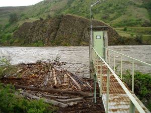
PROVISIONAL DATA SUBJECT TO REVISION

Click to hidestation-specific text
 Salmon River at White Bird, ID May 21 2008; 93,300 CFS - USGS file photo USGS Idaho Water Science Center celebrating more than 100 Years of streamgage Records

Due to a reduction in funding the following changes will be made effective Oct 1, 2019. Temperature will no longer be available at this site.

Real-time temperature funded by the U.S. Army Corps of Engineers.

> Recreation Information

> Rating Information

> NWS River Forecasts

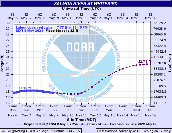
Station operated in cooperation with the Bonneville Power Administration and U.S. Army Corps of Engineers.

This station managed by the Post Falls Field Office.

Available Parameters Available Period
  
2014-07-18  2019-10-01
1986-11-18  2024-04-26
2007-10-01  2024-04-26


 (7)
 

  -- or --


Summary of all available data for this site
Instantaneous-data availability statement


Discharge, cubic feet per second

Most recent instantaneous value: 20000 04-26-2024   01:45 PDT
Graph of  Discharge, cubic feet per second

Add up to 2 more sites and replot for "Discharge, cubic feet per second"

?


Create presentation-quality / stand-alone graph.   Subscribe to WaterAlert      

See this graph on the Monitoring Location Pages


Daily discharge, cubic feet per second -- statistics for Apr 26 based on 111 water years of record more
Min
(1970)
25th
percen-
tile
Median Mean Most Recent
Instantaneous
Value Apr 26
75th
percen-
tile
Max
(2012)
5240 9780 14600 16500 20000 20700 56500


Gage height, feet

Most recent instantaneous value: 18.67 04-26-2024   01:45 PDT
Graph of  Gage height, feet

Add up to 2 more sites and replot for "Gage height, feet"

?


Create presentation-quality / stand-alone graph.   Subscribe to WaterAlert      

See this graph on the Monitoring Location Pages