PROVISIONAL DATA SUBJECT TO REVISION
Click to hidestation-specific text
Funding for this site is provided by:
 STATION.--402452078271301 BLAIR COUNTY, local well
number BA74
STATION.--402452078271301 BLAIR COUNTY, local well
number BA74LOCATION.--Lat 40`24'52.2", long 78`27'12.2", Hydrologic Unit 02050302, at Allegheny Portage Railroad National Historic Site, and southwest of Duncansville.
OWNER.--U.S. Geological Survey.
AQUIFER.--Brallier Formation, Late Devonian age.
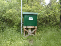
WELL CHARACTERISTICS.--Drilled observation well, diameter 6 in., depth 150 ft, cased to 14 ft, open hole.
INSTRUMENTATION.--Data collection platform with 15-minute recording interval since April 2023; prior, 60-minute recording interval since December 2000. Satellite telemetry at station.
DATUM.--Elevation of land surface is 1,134 ft above North American Vertical Datum of 1988, from Lidar. Measuring point: Top of casing, 1.8 ft above land-surface datum 1969-1999; top of recorder shelf, 3.06 ft above land surface datum June 10, 1999 to June 1, 2011; 3.20 ft above land-surface datum June 1, 2011 through Feb 24, 2016; 3.26 ft above land surface datum Feb 24, 2016 to current.
REMARKS.--Daily maximum, minimum, and mean water levels since June 1999 are available from the District Office.
PERIOD OF RECORD.--August 1969 to current year.
COOPERATION.--Funding for the operation of this station is provided by the Pennsylvania Department of Environmental Protection and the U.S. Geological Survey.
Summary of all available data for this site
Instantaneous-data availability statement
