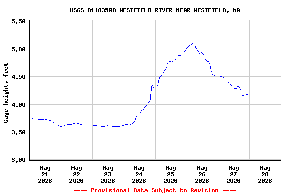
Most recent instantaneous value: 499 05-28-2026 00:15 EDT
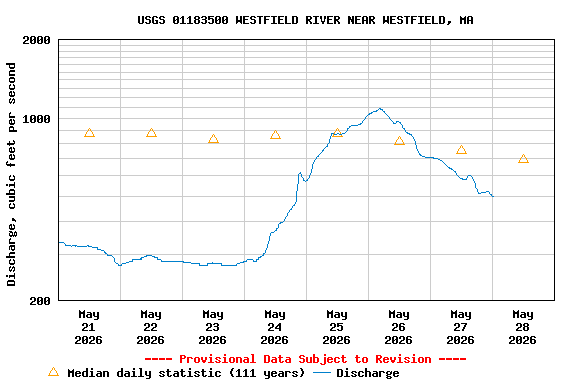
See this graph on the Monitoring Location Pages
| Min (2015) | 25th percen- tile | Most Recent Instantaneous Value May 28 | Median | Mean | 75th percen- tile | Max (1946) |
|---|---|---|---|---|---|---|
| 225 | 445 | 499 | 691 | 919 | 1100 | 6430 |