USGS 01581700 WINTERS RUN NEAR BENSON, MD

PROVISIONAL DATA SUBJECT TO REVISION

Click to hidestation-specific text

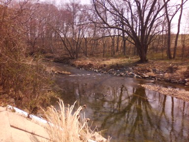
LOCATION.--Lat 39°31'11.8", long 76°22'22.7", Harford County, MD, Hydrologic Unit 02060003, on left
   bank 30 ft downstream from bridge on U.S. Highway 1, 0.1 mi upstream from Heavenly Waters, 1.2 mi
   northeast of Benson, 1.8 mi southwest of Bel Air, and 10.5 mi upstream from mouth.
DRAINAGE AREA.--34.8 mi².
PERIOD OF RECORD.--August 1967 to current year.
GAGE.--Water-stage recorder and crest-stage gage. Datum of gage is 188.28 ft above North American Vertical
   Datum of 1988.
REMARKS.--U.S. Geological Survey satellite data-collection platform at station. Water-quality records for 
   some prior periods have been collected at this location. 
EXTREMES FOR PERIOD OF RECORD.--Maximum discharge, 7,600 ft³/s, June 22, 1972, gage height, 11.60 ft;
   minimum discharge, 0.34 ft³/s, Aug. 22, 23, 2002.
COOPERATION.--Funding for the operation of this station is provided by the Maryland Department of
   Transportation, and the U.S. Geological Survey.
Boating safety tips
This station managed by the MD-DE-DC Water Science Center Baltimore office.

Available Parameters Available Period
  
1990-10-03  2024-04-19
2007-10-01  2024-04-19


 (7)
 

  -- or --


Summary of all available data for this site
Instantaneous-data availability statement


Discharge, cubic feet per second

Most recent instantaneous value: 70.9 04-19-2024   16:15 EDT
Graph of  Discharge, cubic feet per second

Add up to 2 more sites and replot for "Discharge, cubic feet per second"

?


Create presentation-quality / stand-alone graph.   Subscribe to WaterAlert      

See this graph on the Monitoring Location Pages


Daily discharge, cubic feet per second -- statistics for Apr 19 based on 55 water years of record more
Min
(2017)
25th
percen-
tile
Median Mean Most Recent
Instantaneous
Value Apr 19
75th
percen-
tile
Max
(2022)
26.5 37 52 57 70.9 75 138


Gage height, feet

Most recent instantaneous value: 1.72 04-19-2024   16:15 EDT
Graph of  Gage height, feet

Add up to 2 more sites and replot for "Gage height, feet"

?


Create presentation-quality / stand-alone graph.   Subscribe to WaterAlert      

See this graph on the Monitoring Location Pages