USGS 03424860 CANEY FORK AT STONEWALL

PROVISIONAL DATA SUBJECT TO REVISION

Click to hidestation-specific text
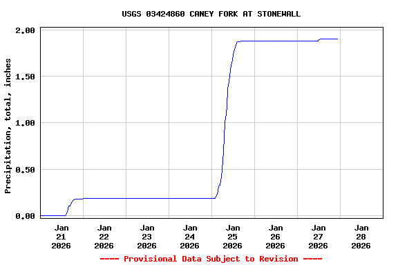
The 15-minute precipitation data for this station are temporary and will only be displayed for 120 days. Time series of 15-minute or cumulative daily values will NOT be available for retrieval following the 120-day display period. Although the instrumentation is calibrated at least once/year, the temporary classification means that documented routine inspections and other quality assurance measures are not performed that would make the data acceptable for archival, retrieval, or future use in general scientific or interpretive studies.
Boating safety tips
> WaterNow – get the latest gage data from your mobile phone or email.
> Rating Information
This station managed by the Nashville Field Office.

Available Parameters Available Period
  
2011-01-07  2024-12-17
2011-01-06  2024-12-17


 (7)
 

  -- or --


Summary of all available data for this site
Instantaneous-data availability statement

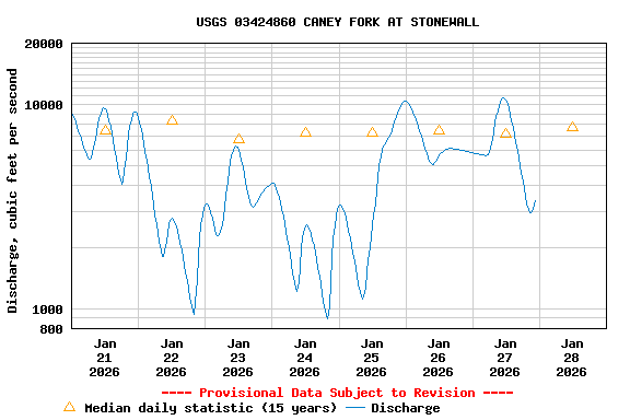
Discharge, cubic feet per second

Most recent instantaneous value: 2400 12-17-2024   22:30 CST
Graph of  Discharge, cubic feet per second

Add up to 2 more sites and replot for "Discharge, cubic feet per second"

?


Create presentation-quality / stand-alone graph.   Subscribe to WaterAlert      

See this graph on the Monitoring Location Pages


Daily discharge, cubic feet per second -- statistics for Dec 17 based on 13 water years of record more
Min
(2024)
Most Recent
Instantaneous
Value Dec 17
25th
percen-
tile
Mean Median 75th
percen-
tile
Max
(2023)
662 2400 3730 7200 7430 11400 13600


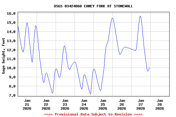
Gage height, feet

Most recent instantaneous value: 9.01 12-17-2024   22:30 CST
Graph of  Gage height, feet

Add up to 2 more sites and replot for "Gage height, feet"

?


Create presentation-quality / stand-alone graph.   Subscribe to WaterAlert      

See this graph on the Monitoring Location Pages