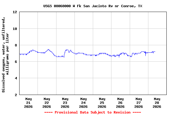
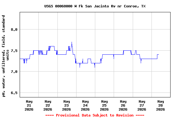
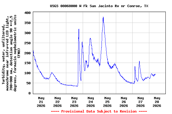
PROVISIONAL DATA SUBJECT TO REVISION
Click to hidestation-specific text
| Funding for this site is provided by the cooperators / programs below: | |
|
City of Houston |
San Jacinto River Authority |
|
Texas Water Development Board |
Cooperative Matching Funds |
|
|
|
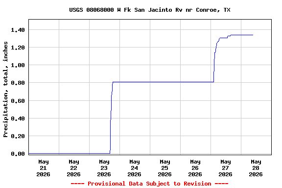
| Rainfall Disclaimer | |
|
|
|
|
Retransmission, forecasts and summary by the National Weather Service |
|
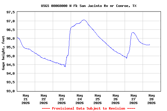
Datum of gage changed from 95.03 ft above NGVD 1929 to NAVD 1988, 2001 adjustment, on Oct. 1, 2012. New datum is 93.80 ft below previous datum.
Summary of all available data for this site
Instantaneous-data availability statement