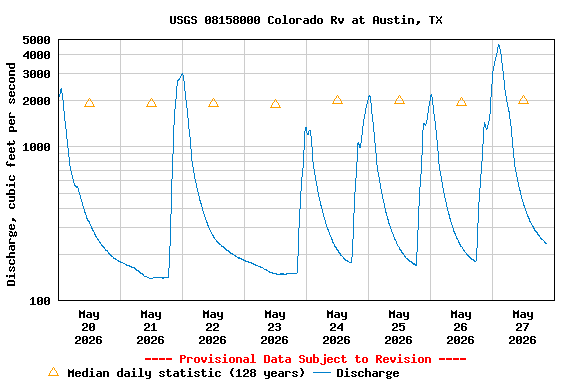
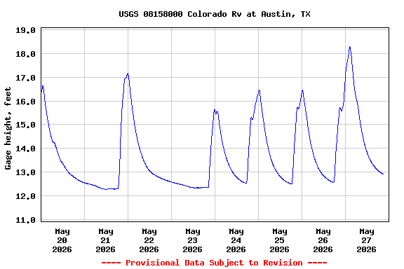
PROVISIONAL DATA SUBJECT TO REVISION
Click to hidestation-specific text
| Funding for this site is provided by the cooperators / programs below: | |
|
Lower Colorado River Authority |
Cooperative Matching Funds |
|
Centennial Gage |
|
|
|
|
|
Retransmission, forecasts and summary by the National Weather Service |
|
Effective December 31, 2011, the gage height data are collected at a new location approximately 4,500 feet downstream. The difference in gage height between the two sites is about 9.13 feet. Mean-sea level elevations may be calculated by adding 391.97 feet to gage height values for the new site.
Summary of all available data for this site
Instantaneous-data availability statement