USGS 50023110 LAGO VIVI NEAR UTUADO, PR

PROVISIONAL DATA SUBJECT TO REVISION

Click to hidestation-specific text
Click to go to the Autoridad de Energia Electrica de Puerto Rico web page
Image of Lago Vivi near Utuado
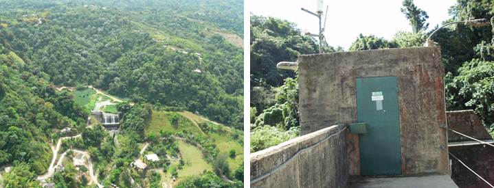
Aerial photos courtesy of Puerto Rico Energy and Power Authority (PREPA).
This station managed by the Caribbean-Florida WSC - San Juan.

Available Parameters Available Period
  
2016-10-13  2024-04-18
2007-10-01  2024-04-18
2007-10-01  2024-04-18
2007-10-01  2024-04-18
2007-10-01  2024-04-18


 (7)
 

  -- or --


Summary of all available data for this site
Instantaneous-data availability statement


Precipitation, total, inches

Most recent instantaneous value: 0.00 04-18-2024   03:45 AST
Graph of  Precipitation, total, inches

Add up to 2 more sites and replot for "Precipitation, total, inches"

?


Create presentation-quality / stand-alone graph.   Subscribe to WaterAlert      

See this graph on the Monitoring Location Pages


Lake or reservoir elevation above local mean sea level (LMSL), feet, [OLDPR]

Most recent instantaneous value: 1065.04 04-18-2024   03:45 AST
Graph of  Lake or reservoir elevation above local mean sea level (LMSL), feet, [OLDPR]

Add up to 2 more sites and replot for "Lake or reservoir elevation above local mean sea level (LMSL), feet, [OLDPR]"

?


Create presentation-quality / stand-alone graph.   Subscribe to WaterAlert      

See this graph on the Monitoring Location Pages


Lake or reservoir elevation above local mean sea level (LMSL), meters, [OLDPR]

Most recent instantaneous value: 324.624 04-18-2024   03:45 AST
Graph of  Lake or reservoir elevation above local mean sea level (LMSL), meters, [OLDPR]

Add up to 2 more sites and replot for "Lake or reservoir elevation above local mean sea level (LMSL), meters, [OLDPR]"

?


Create presentation-quality / stand-alone graph.   Subscribe to WaterAlert      

See this graph on the Monitoring Location Pages


Lake or reservoir elevation, above Puerto Rico Datum of 2002, feet

Most recent instantaneous value: 1064.34 04-18-2024   03:45 AST
Graph of  Lake or reservoir elevation, above Puerto Rico Datum of 2002, feet

Add up to 2 more sites and replot for "Lake or reservoir elevation, above Puerto Rico Datum of 2002, feet"

?


Create presentation-quality / stand-alone graph.   Subscribe to WaterAlert      

See this graph on the Monitoring Location Pages


Lake or reservoir elevation, above Puerto Rico Datum of 2002, meters

Most recent instantaneous value: 324.411 04-18-2024   03:45 AST
Graph of  Lake or reservoir elevation, above Puerto Rico Datum of 2002, meters

Add up to 2 more sites and replot for "Lake or reservoir elevation, above Puerto Rico Datum of 2002, meters"

?


Create presentation-quality / stand-alone graph.   Subscribe to WaterAlert      

See this graph on the Monitoring Location Pages