LOCATION.--Lat 42°09'23.2", long
79°23'37.8" referenced to North American Datum of
1983, Chautauqua County, NY, Hydrologic Unit 05010002, 6 ft
east of lake shore, 30 ft south of the intersection of Pauline
Avenue and Lakeside Avenue, and 950 ft southeast of the ferry
landing at Bemus Point.
DRAINAGE AREA.--189 mi².
PERIOD OF RECORD.--October 1972 to September 1973,
November 1974 to current year.
GAGE.--Water-stage recorder and crest-stage gage. Lake
elevation record is provided in NGVD of 1929 and NAVD of 1988
datums. To convert NGVD of 1929 elevations to NAVD of
1988, subtract 0.49 ft. Prior to November 1974, at site 950 ft
northwest at same datum.
REMARKS.--Lake regulated for flood control by Warner
Dam. Area of water surface, 20.98 mi².
EXTREMES FOR PERIOD OF RECORD.--Maximum elevation,
1,311.23 ft above NGVD of 1929 (1,310.74 ft above NAVD of
1988), Mar. 5, 1976; minimum elevation, 1,306.20 ft above NGVD
of 1929 (1,305.71 ft above NAVD of 1988), Dec. 16, 1998.

 Site Information
 WaterAlert – get an
email or text (SMS) alert based on your chosen threshold.
WaterAlert – get an
email or text (SMS) alert based on your chosen threshold.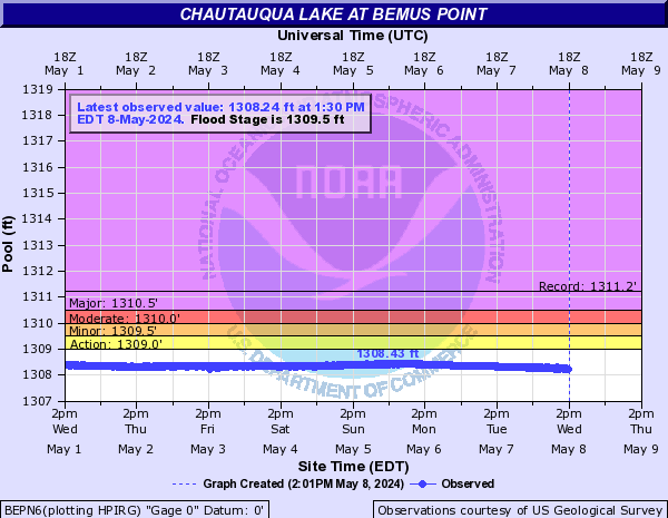
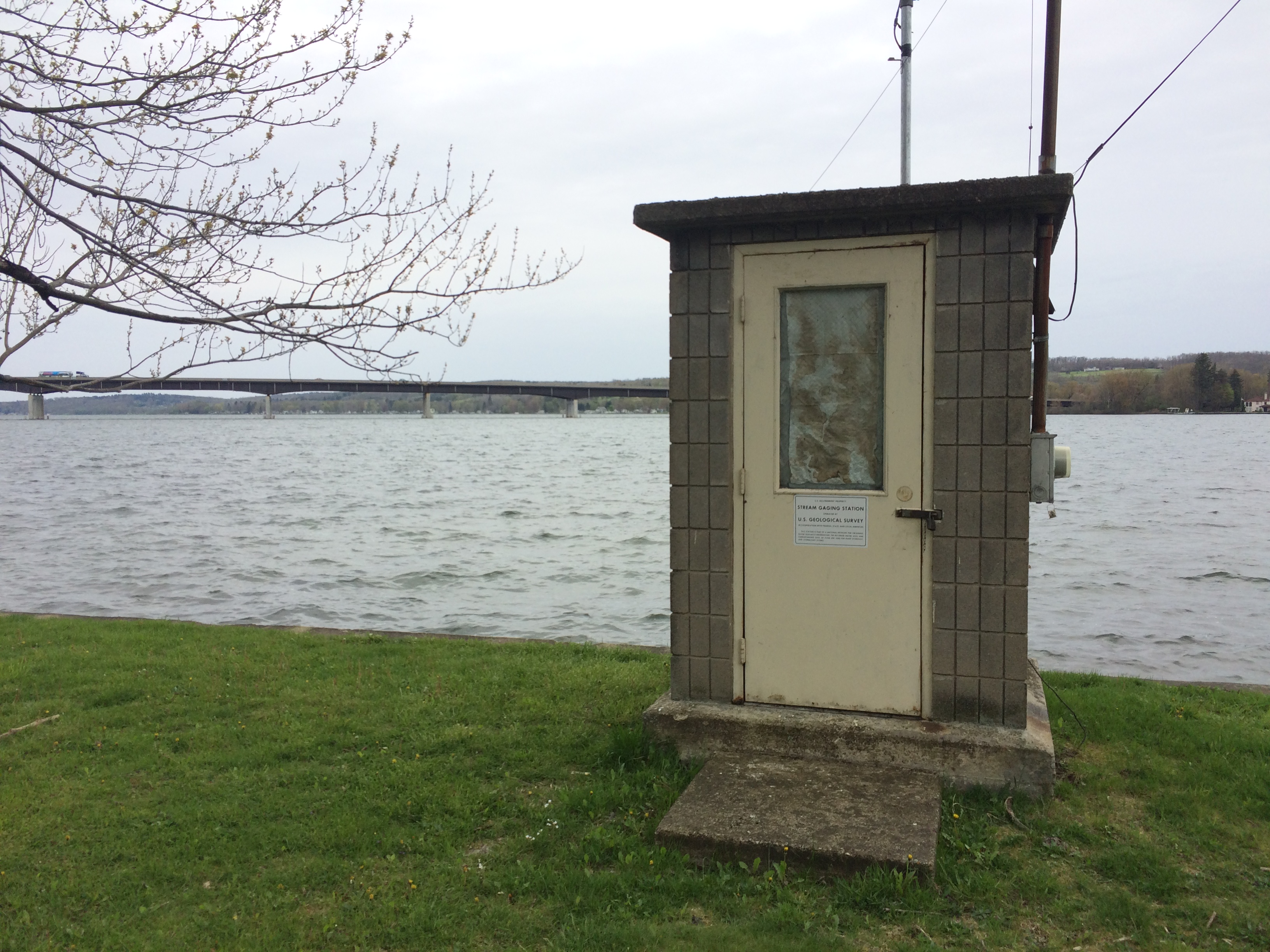 Station image
