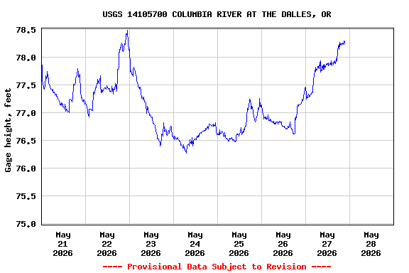
Most recent instantaneous value: 162000 05-28-2026 05:15 PDT
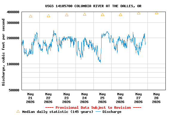
See this graph on the Monitoring Location Pages
| Min (2001) | Most Recent Instantaneous Value May 28 | 25th percen- tile | Median | Mean | 75th percen- tile | Max (1894) |
|---|---|---|---|---|---|---|
| 113000 | 162000 | 295000 | 386000 | 395000 | 487000 | 936000 |