PROVISIONAL DATA SUBJECT TO REVISION
Click to hidestation-specific text
Funding for this site is provided by:
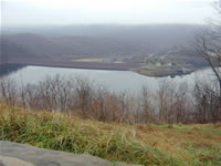 STATION.--01563100 RAYSTOWN LAKE NEAR HUNTINGDON,
PA
STATION.--01563100 RAYSTOWN LAKE NEAR HUNTINGDON,
PALOCATION.--Lat 40`26'06", long 78`00'25", Huntingdon County, Hydrologic Unit 02050303, at Raystown Dam on Raystown Branch Juniata River, 3.5 mi south of Huntingdon, and 5.7 mi upstream from mouth.
DRAINAGE AREA.--959 square miles.
PERIOD OF RECORD.--October 1972 to current year.
GAGE.--Water-stage recorder and heated tipping bucket precipitation gage. Datum of gage is U.S. Army Corps of Engineers local project datum. Prior to water year 2007, the datum was incorrectly reported as NGVD 1929. Satellite telemetry at station.
REMARKS.--Reservoir is formed by earthfill dam with a gated spillway in right abutment at elevation 768.6 ft (capacity, 383,500 acre-ft), and an ungated spillway separate from embankment at elevation 812.0 ft (capacity, 762,000 acre-ft). Storage began November 1972. Conservation pool elevation is 786.0 ft, capacity 514,000 acre-ft. Lake is used for flood control, low-flow augmentation, and recreation.
| The 15-minute precipitation data for this station are temporary and will only be displayed for 120 days. Time series of 1-hour or cumulative daily values will NOT be available for retrieval following the 120-day display period. Although the instrumentation is calibrated at least once a year, the temporary classification means that documented routine inspections and other quality assurance measures are not performed that would make the data acceptable for archival, retrieval, or future use in general scientific or interpretive studies. |
COOPERATION.--Funding for the operation of this station is provided by the U.S. Army Corps of Engineers, Baltimore District and the U.S. Geological Survey.
Summary of all available data for this site
Instantaneous-data availability statement


