USGS 50075550 LAGO ICACOS AT DAMSITE, PR

PROVISIONAL DATA SUBJECT TO REVISION

Click to hidestation-specific text
Click to go to the Autoridad de Energia Electrica de Puerto Rico web page

Station Drainage Area


Image of Lago Icacos at Damsite
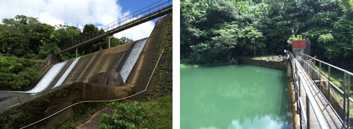
Photos by USGS, Caribbean-Florida Water Science Center Hydrologic Technicians - San Juan.
This station managed by the Caribbean-Florida WSC - San Juan.

Available Parameters Available Period
  
2018-09-28  2022-12-28
2007-10-01  2024-04-18
2007-10-01  2024-04-18
2007-10-01  2024-04-18
2007-10-01  2024-04-18


 (31)
 

  -- or --


Summary of all available data for this site
Instantaneous-data availability statement


Lake or reservoir elevation above local mean sea level (LMSL), feet, [OLDPR]

Most recent instantaneous value: 1860.10 04-18-2024   19:45 AST
Graph of  Lake or reservoir elevation above local mean sea level (LMSL), feet, [OLDPR]

Add up to 2 more sites and replot for "Lake or reservoir elevation above local mean sea level (LMSL), feet, [OLDPR]"

?


Create presentation-quality / stand-alone graph.   Subscribe to WaterAlert      

See this graph on the Monitoring Location Pages


Lake or reservoir elevation above local mean sea level (LMSL), meters, [OLDPR]

Most recent instantaneous value: 566.958 04-18-2024   19:45 AST
Graph of  Lake or reservoir elevation above local mean sea level (LMSL), meters, [OLDPR]

Add up to 2 more sites and replot for "Lake or reservoir elevation above local mean sea level (LMSL), meters, [OLDPR]"

?


Create presentation-quality / stand-alone graph.   Subscribe to WaterAlert      

See this graph on the Monitoring Location Pages


Lake or reservoir elevation, above Puerto Rico Datum of 2002, feet

Most recent instantaneous value: 1464.00 04-18-2024   19:45 AST
Graph of  Lake or reservoir elevation, above Puerto Rico Datum of 2002, feet

Add up to 2 more sites and replot for "Lake or reservoir elevation, above Puerto Rico Datum of 2002, feet"

?


Create presentation-quality / stand-alone graph.   Subscribe to WaterAlert      

See this graph on the Monitoring Location Pages


Lake or reservoir elevation, above Puerto Rico Datum of 2002, meters

Most recent instantaneous value: 446.227 04-18-2024   19:45 AST
Graph of  Lake or reservoir elevation, above Puerto Rico Datum of 2002, meters

Add up to 2 more sites and replot for "Lake or reservoir elevation, above Puerto Rico Datum of 2002, meters"

?


Create presentation-quality / stand-alone graph.   Subscribe to WaterAlert      

See this graph on the Monitoring Location Pages