PROVISIONAL DATA SUBJECT TO REVISION
Click to hidestation-specific text
Funding for this site is provided by:
 Site Information
LOCATION.--Lat 43°04'06.7", long
74°59'17.8" referenced to North American Datum of
1983, Herkimer County, NY, Hydrologic Unit 02020004, on right
bank 600 ft downstream from bridge on old State Highway 28 at
Kast Bridge, 1.2 mi downstream from North Creek, 2.2 mi north
of Herkimer, and 4.0 mi upstream from mouth.
DRAINAGE AREA.--560 mi².
PERIOD OF RECORD.--January 1907, April to December 1907, March 1908 to December 1909, April 1910 to December 1911 (monthly discharges only, published in WSP 1302), January 1912 to December 1913, April 1914 to June 1918 (monthly discharges only for most months, published in WSP 1302), October 1920 to current year. Record prior to October 1920 furnished by State engineer and surveyor of New York.
REVISIONS HISTORY.--WDR NY-85-1: Drainage area.
GAGE.--Water-stage recorder and crest-stage gage. Datum of gage is 438.99 ft above NGVD of 1929 and 438.46 ft above NAVD of 1988. Prior to Sept. 18, 1920, nonrecording gage at former highway bridge 500 ft upstream at different datum. Sept. 18, 1920 to Oct. 23, 1985, at site on left bank at present datum.
REMARKS.--Since March 1914, flow regulated by Hinckley Reservoir, 31 mi upstream from station (usable capacity, 3,320 mil ft³). Diurnal fluctuation at low and medium flow caused by powerplants upstream from station. Diversion at Trenton Falls, 26 mi upstream from station, by Ninemile feeder since 1915 during canal navigation season. Diversion from Hinckley Reservoir for Utica water supply returned to Mohawk River.
Water Years 2014-20: Records good except those for estimated daily discharges, which are poor. Water Years 2021-23: Records fair except those for estimated daily discharges, which are poor.
EXTREMES FOR PERIOD OF RECORD.--Maximum discharge, since construction of Hinckley Reservoir in 1914, 27,500 ft³/s, Oct. 31, 2019, gage height, 10.94 ft; minimum discharge, 20 ft³/s, Sept. 3, 1929, gage height, 0.90 ft.
EXTREMES FOR PERIOD PRIOR TO REGULATION.--Maximum discharge, prior to construction of Hinckley Reservoir in 1914, 23,300 ft³/s, Mar. 26, 1913, from reports of State engineer and surveyor of New York.
 WaterAlert – get an
email or text (SMS) alert based on your chosen threshold.
WaterAlert – get an
email or text (SMS) alert based on your chosen threshold.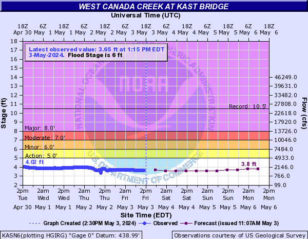
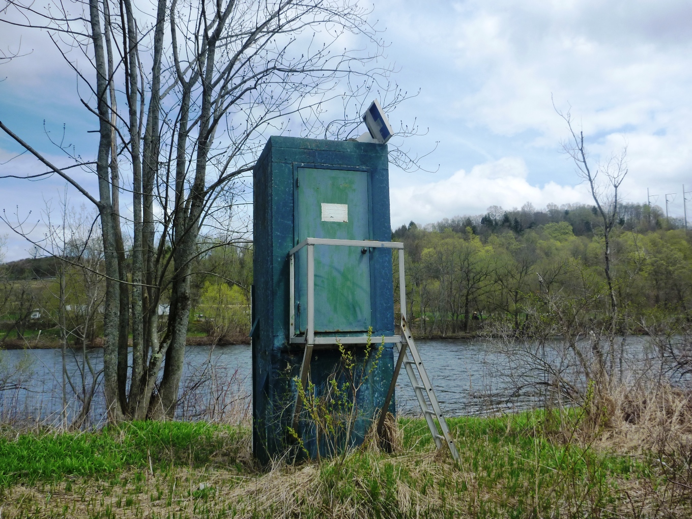 Station image
Summary of all available data for this site
Instantaneous-data availability statement

