PROVISIONAL DATA SUBJECT TO REVISION
Click to hidestation-specific text
Funding for this site is provided by:
 Site Information
LOCATION.--Lat 41°50'35.1", long
74°05'10.0" referenced to North American Datum of
1983, Ulster County, NY, Hydrologic Unit 02020007, on left bank
30 ft upstream from bridge on James Street in Rosendale, and 3
mi upstream from Wallkill River.
DRAINAGE AREA.--383 mi².
PERIOD OF RECORD.--July 1901 to November 1903, October 1905 to December 1906 (monthly discharges only, published in WSP 1302), January 1907 to December 1913, January 1914 to January 1919 (monthly discharges only, published in WSP 1302), August 1926 to current year (monthly discharge only, January to May and September 1970).
REVISIONS HISTORY.--WSP 756: 1933. WDR NY-90-1: Drainage Area. WDR NY-92-1: 1903.
GAGE.--Water-stage recorder and crest-stage gage. Datum of gage is 32.83 ft above NGVD of 1929 and 31.94 ft above NAVD of 1988. Prior to January 1919, nonrecording gage at site 150 ft downstream at datum 6.00 ft higher; Aug. 3, 1926 to Nov. 17, 1968, at present site at datum 10.00 ft higher. Nov. 18, 1968 to Feb. 3, 1970, at temporary site 0.2 mi upstream at datum 11.20 ft higher; Feb. 4 to June 8, 1970, there was no gage, gage destroyed by flood; June 9, 1970 to Jan. 18, 1971, nonrecording gage at temporary site 0.2 mi upstream at datum 11.20 ft higher; all during period of flood-control channel construction.
REMARKS.--Occasional regulation from hydroelectric plant upstream from station. Diversion upstream from station during navigation season for Delaware and Hudson Canal, 1901-19. Diversion from Rondout Creek through the emergency connection to the Delaware Aqueduct at Lackawack for New York City water supply during April 1944 to May 1951. Since October 1950, flow regulated by Rondout Reservoir (station 01366400). Subsequent to May 1951, entire flow except for conservation releases and periods of spill, diverted from Rondout Reservoir for New York City water supply. Discharge records for this station now represent the natural flow from 288 mi² together with conservation releases and spillage during high flow from Rondout Reservoir.
Water Years 2014-23: Records good except those for estimated daily discharges, which are poor.
EXTREMES FOR PERIOD OF RECORD.--Maximum discharge, 36,500 ft³/s, Aug. 28, 2011, gage height, 26.96 ft; maximum gage height, 36.8 ft, Oct. 16, 1955, present datum, from floodmarks; minimum discharge, 2.2 ft³/s, July 16, 1965.
 WaterAlert – get an
email or text (SMS) alert based on your chosen threshold.
WaterAlert – get an
email or text (SMS) alert based on your chosen threshold.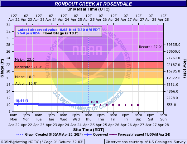
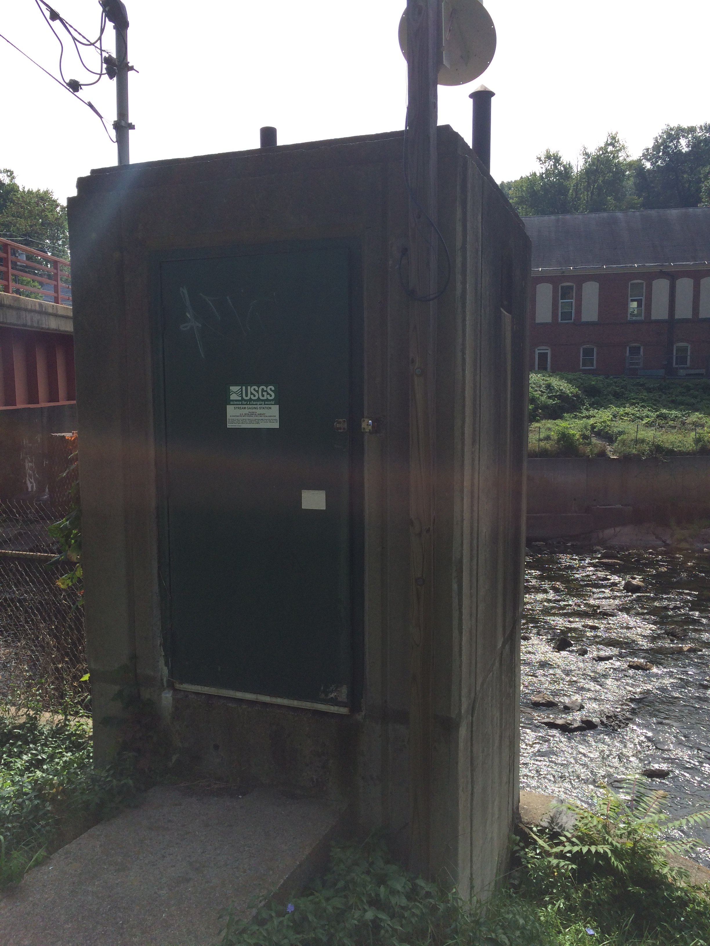 Station image
Summary of all available data for this site
Instantaneous-data availability statement

