PROVISIONAL DATA SUBJECT TO REVISION
Click to hidestation-specific text
|
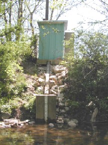 |
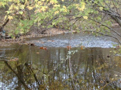
LOCATION.--Lat 39°20'45.2", long 76°43'59.5", Baltimore County, MD, Hydrologic Unit 02060003,
   on right bank 300 ft downstream from bridge on Essex Road, 300 ft north of State Highway 26
   (Liberty Road), in Villa Nova, 1.1 mi west of Baltimore City limits, and 11.5 mi upstream
   from mouth.
DRAINAGE AREA.--32.5 mi2.
PERIOD OF RECORD.--February 1957 to September 1988, October 1996 to current year.
REVISIONS HISTORY.--WDR MD-DE-83: 1981-82(P). WDR MD-DE-84: 1981(P).
   https://waterdata.usgs.gov/nwis/dv/?site_no=01589300: 2011-2014
GAGE.--Water-stage recorder and crest-stage gage. Datum of gage is 360.61 ft above North American Vertical
   Datum of 1988. Prior to Aug. 27, 1963, and Oct. 25, 1972 to Sept. 20, 1973, water-stage recorder,
   and June 26, 1972 to Oct. 24, 1972, nonrecording gage, at site 300 ft upstream at same gage datum.
REMARKS.--Slight diurnal fluctuation at times from unknown source upstream from station. Small diversion for
   irrigation upstream from station. U.S. Geological Survey satellite data-collection platform at station.
   Water-quality records for some prior periods have been collected at this location.
EXTREMES FOR PERIOD OF RECORD.--Maximum discharge, 16,200 ft3/s, Jun. 22, 1972, gage height, 21.50 ft;
   minimum discharge, 1.7 ft3/s, Sep. 7, 8, 1966.
EXTREMES OUTSIDE PERIOD OF RECORD.--Flood of July 21, 1956 reached a stage of 12.6 ft; discharge,
   5,270 ft3/s, on basis of contracted-opening measurement.
COOPERATION.--Funding for the operation of this station is provided by the Baltimore County Department
   of Environmental Protection & Sustainability and the U.S. Geological Survey.
Summary of all available data for this site
Instantaneous-data availability statement

