USGS Water Resources    


News - updated November 2009


USGS 01595800 NORTH BRANCH POTOMAC RIVER AT BARNUM, WV


PROVISIONAL DATA SUBJECT TO REVISION


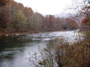
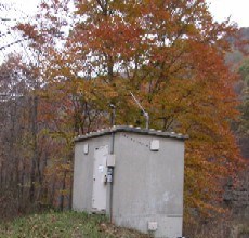
LOCATION.-- Lat 39°26'42.4", long 79°06'38.9", Mineral County, W. Va., Hydrologic Unit 02070002,
   on right bank at highway bridge at Barnum, W. Va., 0.4 mi upstream from Folly Run, 4.0 mi
   southwest of Piedmont, W. Va., and at mile 59.4.
DRAINAGE AREA.--266 mi2.
PERIOD OF RECORD.--July 1966 to current year.
GAGE.--Water-stage recorder and crest-stage gage.  Datum of gage is 1,151.82 ft above National Geodetic
   Vertical Datum of 1929. Since Oct. 1, 1985, operated as a crest-stage partial-record
REMARKS.--Prior to July 1981 regulation of low flow by Stony River Reservoir, 39 mi upstream from station.
   Since July 1981 complete regulation by Jennings Randolph Lake, 1.5 mi upstream from station,
   capacity 96,600 acre-ft. U.S. Geological Survey satellite collection platform at station.
EXTREMES FOR PERIOD OF RECORD.--Maximum discharge, 27,100 ft3/s, July 3, 1978,
   gage height, 13.37 ft; minimum discharge, 0.91 ft3/s, Aug. 12, 1981.
COOPERATION.--Funding for the operation of this station is provided by the U.S. Army Corps of Engineers,
   and the U.S. Geological Survey.


Available Parameters
All 5 Available Parameters for this site
00010 Temperature, water
00060 Discharge
00065 Gage height
00095 Specific cond at 25C
00400 pH

Graph
Graph w/ stats
Graph w/o stats
Table
Tab-separated
Days

 (1-60)
 

Summary of all available data for this site

Temperature, water, degrees Celsius
Most recent instantaneous value: 11.5   11-23-2009  15:00 EST
Graph of  Temperature, water, degrees Celsius    
Create presentation-quality / stand-alone graph parm 00010 DD01

Discharge, cubic feet per second
Most recent instantaneous value: 148   11-23-2009  15:15 EST
Graph of  Discharge, cubic feet per second    
Create presentation-quality / stand-alone graph parm 00060 DD02
Daily discharge statistics, in cfs, for Nov 23 based on 24 years of record more
Min
(1979)
Most Recent
Instantaneous
Value
20th
percen-
tile
Median Mean 80th
percen-
tile
Max
(2004)
104 148 160. 264 371 475 1480

Gage height, feet
Most recent instantaneous value: 2.71   11-23-2009  15:15 EST
Graph of  Gage height, feet    
Create presentation-quality / stand-alone graph parm 00065 DD03

Specific conductance, water, unfiltered, microsiemens per centimeter at 25 degrees Celsius
Most recent instantaneous value: 478   11-23-2009  15:00 EST
Graph of  Specific conductance, water, unfiltered, microsiemens per centimeter at 25 degrees Celsius    
Create presentation-quality / stand-alone graph parm 00095 DD04

pH, water, unfiltered, field, standard units
Most recent instantaneous value: 7.6   11-23-2009  15:00 EST
Graph of  pH, water, unfiltered, field, standard units    
Create presentation-quality / stand-alone graph parm 00400 DD06

Questions about sites/data? Top
Feedback on this web site Explanation of terms
Automated retrievals Subscribe for system changes
Help News

Accessibility FOIA Privacy Policies and Notices

Take Pride in America logo USA.gov logo U.S. Department of the Interior | U.S. Geological Survey
Title: USGS Real-Time Water Data for the Nation
URL: http://waterdata.usgs.gov/nwis/uv?

Page Contact Information: Maryland Water-Data Support Team
Page Last Modified: 2009-11-23 16:17:15 EST
2.03   1.93 ca02