USGS Water Resources    


News - updated January 2010


USGS 01597500 SAVAGE RIV BL SAVAGE RIV DAM NEAR BLOOMINGTON, MD


PROVISIONAL DATA SUBJECT TO REVISION


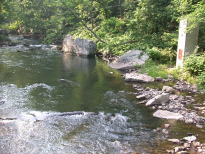
LOCATION.--Lat 39°30'09.9", long 79°07'26.3", Garrett County, Hydrologic Unit 02070002,
   on left bank 0.7 mi downstream from Savage River Dam, 1.1 mi downstream from Crabtree Creek, 3.2 mi
   northwest of Bloomington, and 3.7 mi upstream from mouth.
DRAINAGE AREA.--106 mi2
PERIOD OF RECORD.--October 1948 to current year.
GAGE.--Water-stage recorder and concrete control. Datum of gage is 1,276.40 ft above National
   Geodetic Vertical Datum of 1929.
REMARKS.--Diversions upstream from station by Baltimore and Ohio Railroad and by cities of Frostburg
   and Westernport for municipal supply. Flow regulated by Savage River Reservoir beginning December 1950,
   capacity 20,000 acre-ft. U.S. Army Corps of Engineers satellite collection platform at station. Upper
   Potomac River Commission gage-height telemeter at station.
EXTREMES FOR PERIOD OF RECORD.--Maximum discharge, 9,190 ft3/s, Sept. 7, 1996,
   gage height, 10.09 ft; minimum discharge, 0.35 ft3/s, Oct. 27, 1966.
COOPERATION.--Funding for the operation of this station is provided by the Upper Potomac River Commission,
   U.S. Army Corps of Engineers, and the U.S. Geological Survey.


Available Parameters
All 3 Available Parameters for this site
00060 Discharge
00065 Gage height
00010 Temperature, water

Graph
Graph w/ stats
Graph w/o stats
Table
Tab-separated
Days

 (1-120)
 

Summary of all available data for this site

Discharge, cubic feet per second
Most recent instantaneous value: 81   02-10-2010  03:15 EST
Graph of  Discharge, cubic feet per second    
Create presentation-quality / stand-alone graph parm 00060 DD01
Daily discharge statistics, in cfs, for Feb 10 based on 59 years of record more
Min
(1954)
20th
percen-
tile
Most Recent
Instantaneous
Value
Median Mean 80th
percen-
tile
Max
(1965)
8.1 72 81 110. 211 386 1070

Gage height, feet
Most recent instantaneous value: 0.97   02-10-2010  03:15 EST
Graph of  Gage height, feet    
Create presentation-quality / stand-alone graph parm 00065 DD02

Temperature, water, degrees Celsius
Most recent instantaneous value: 1.8   02-10-2010  03:00 EST
Graph of  Temperature, water, degrees Celsius    
Create presentation-quality / stand-alone graph parm 00010 DD03

Questions about sites/data? Top
Feedback on this web site Explanation of terms
Automated retrievals Subscribe for system changes
Help News

Accessibility FOIA Privacy Policies and Notices

Take Pride in America logo USA.gov logo U.S. Department of the Interior | U.S. Geological Survey
Title: USGS Real-Time Water Data for the Nation
URL: http://waterdata.usgs.gov/nwis/uv?

Page Contact Information: Maryland Water-Data Support Team
Page Last Modified: 2010-02-10 04:11:06 EST
1.49   1.5 ca02