PROVISIONAL DATA SUBJECT TO REVISION
Click to hidestation-specific text
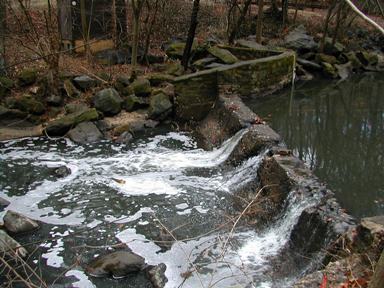
LOCATION.--Lat 38°59'10.4", long 77°00'17.5", Montgomery County, MD, Hydrologic Unit 02070010,
   0.5 mi northwest of Takoma Park, 0.7 mi upstream from confluence with Long Branch, 2.0 mi upstream
   from mouth.
DRAINAGE AREA.--6.45 mi2.
PERIOD OF RECORD.--October 2008 to current year.
GAGE.--Water-stage recorder, crest-stage gage and concrete control. Datum of gage is 161.27 ft above
   North American Vertical Datum of 1988.
REMARKS.--U.S. Geological Survey satellite data-collection platform at station.
EXTREMES FOR PERIOD OF RECORD.--Maximum discharge, 3,250 ft³/s, Sept. 10, 2020, gage height, 6.87 ft;
   minimum discharge, 0.10 ft³/s, Sept. 11, 2015, as a result of regulation upstream from station.
COOPERATION.--Funding for the operation of this station is provided by the Montgomery County
   Department of Environmental Protection, and the U.S. Geological Survey.
Disclaimer Any use of trade, firm, or product names is for descriptive purposes only and does not
imply endorsement by the U.S. Government.
Summary of all available data for this site
Instantaneous-data availability statement


