PROVISIONAL DATA SUBJECT TO REVISION
Click to hidestation-specific text
Funding for this site is provided by:
 Site Information
LOCATION.--Lat 43°18'41", long
75°06'30" referenced to North American Datum of 1927,
Oneida County, NY, Hydrologic Unit 02020004, on south side of
north gatehouse at Hinckley Dam on West Canada Creek at
Hinckley, and 2.2 mi east of Prospect.
DRAINAGE AREA.--372 mi².
PERIOD OF RECORD.--March 1914 to September 2007 (month-end elevations and contents), October 2007 to September 2013 (daily mean elevations and month-end contents), October 2013 to current year (daily mean elevations). In 2008 water year, daily mean elevations for April 1996 through September 2008 published.
REVISIONS HISTORY.--WDR NY-85-1: Drainage area.
GAGE.--Water-stage recorder. Datum of gage is Barge Canal datum. To convert elevations to NGVD of 1929, subtract 1.04 ft. To convert elevations to NAVD of 1988, subtract 1.36 ft.
COOPERATION.--Capacity table provided by New York State Canal Corporation.
REMARKS.--Reservoir is formed by earth and concrete dam; storage began March 1914. Usable capacity 3,320 mil ft³ between elevation 1,173.5 and 1,225.0 ft. Elevation of inverts of four 60-inch discharge pipes at north end of spillway is 1,169.5 ft, and elevation of inverts of two 42-inch pipes at south end for diverting water to city of Utica is 1,164.25 ft. Crest of ogee spillway is at elevation 1,225.0 ft. Length of spillway is 400 ft. Area of water surface at crest elevation is 4.46 mi². Figures given herein represent usable contents. Diversion for municipal supply of Utica began prior to 1921. Diversion records (01343899) provided by Mohawk Valley Water Authority.
EXTREMES FOR PERIOD OF RECORD.--Maximum contents, 4,240 mil ft³, Nov. 1, 2019, elevation, 1,231.49 ft; minimum contents observed, 25 mil ft³, Nov. 17, 1964, elevation, 1,174.9 ft (from Report to the Governor by the Hinckley Reservoir Working Group, 2008).
DRAINAGE AREA.--372 mi².
PERIOD OF RECORD.--March 1914 to September 2007 (month-end elevations and contents), October 2007 to September 2013 (daily mean elevations and month-end contents), October 2013 to current year (daily mean elevations). In 2008 water year, daily mean elevations for April 1996 through September 2008 published.
REVISIONS HISTORY.--WDR NY-85-1: Drainage area.
GAGE.--Water-stage recorder. Datum of gage is Barge Canal datum. To convert elevations to NGVD of 1929, subtract 1.04 ft. To convert elevations to NAVD of 1988, subtract 1.36 ft.
COOPERATION.--Capacity table provided by New York State Canal Corporation.
REMARKS.--Reservoir is formed by earth and concrete dam; storage began March 1914. Usable capacity 3,320 mil ft³ between elevation 1,173.5 and 1,225.0 ft. Elevation of inverts of four 60-inch discharge pipes at north end of spillway is 1,169.5 ft, and elevation of inverts of two 42-inch pipes at south end for diverting water to city of Utica is 1,164.25 ft. Crest of ogee spillway is at elevation 1,225.0 ft. Length of spillway is 400 ft. Area of water surface at crest elevation is 4.46 mi². Figures given herein represent usable contents. Diversion for municipal supply of Utica began prior to 1921. Diversion records (01343899) provided by Mohawk Valley Water Authority.
Capacity table (elevation, in feet, and usable contents, in millions of cubic feet)

Elevation  Contents      Elevation  Contents
1,173.5        0         1,205.0    1,440
1,175.0       27         1,215.0    2,260
1,185.0      306         1,225.0    3,320
1,195.0      787         1,230.0    4,010
EXTREMES FOR PERIOD OF RECORD.--Maximum contents, 4,240 mil ft³, Nov. 1, 2019, elevation, 1,231.49 ft; minimum contents observed, 25 mil ft³, Nov. 17, 1964, elevation, 1,174.9 ft (from Report to the Governor by the Hinckley Reservoir Working Group, 2008).
 WaterAlert – get an
email or text (SMS) alert based on your chosen threshold.
WaterAlert – get an
email or text (SMS) alert based on your chosen threshold.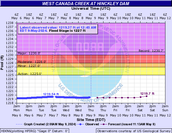
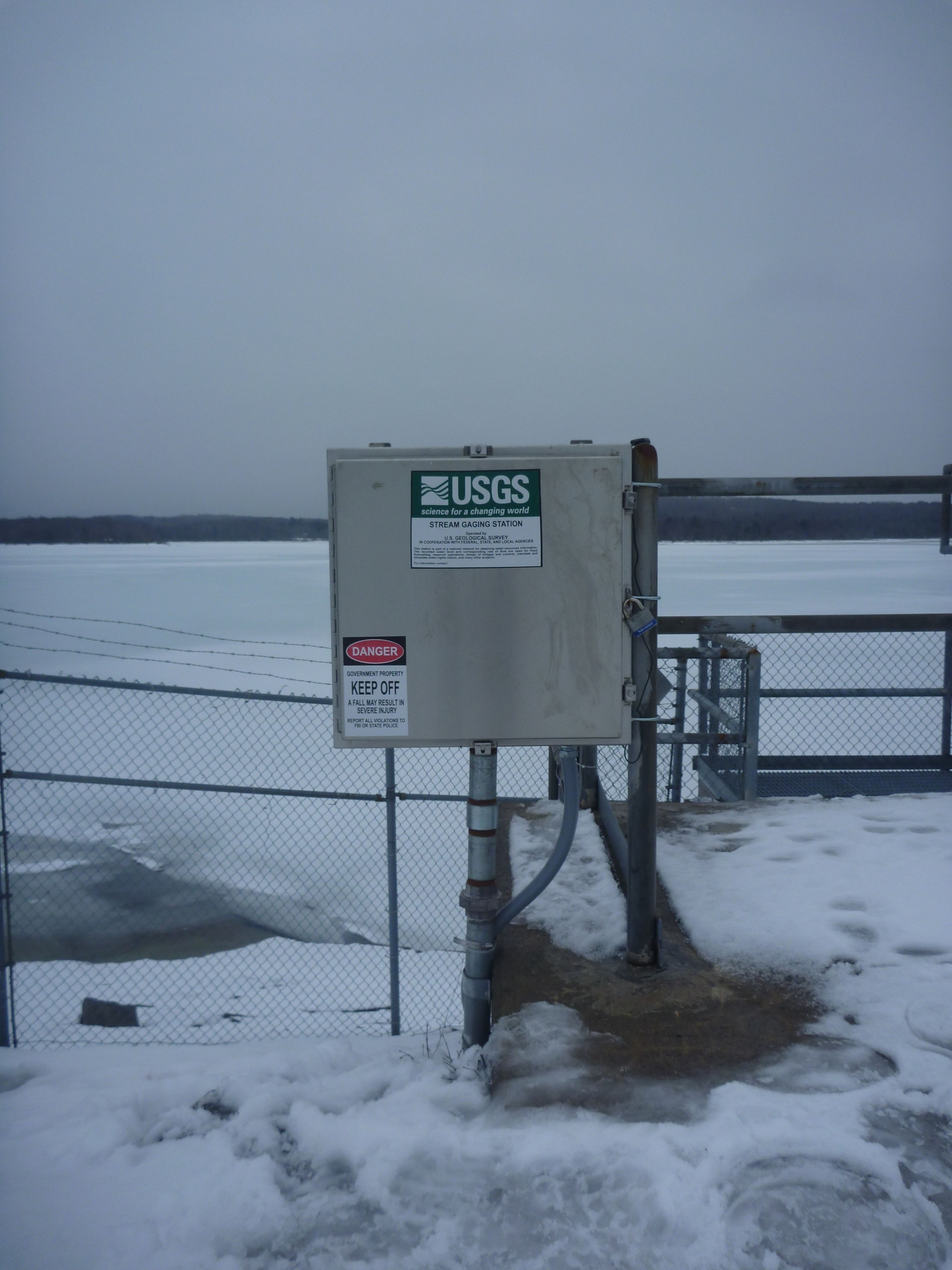 Station image
Summary of all available data for this site
Instantaneous-data availability statement

