PROVISIONAL DATA SUBJECT TO REVISION
Click to hidestation-specific text
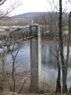
LOCATION.--Lat 39°32'19.9", long 78°27'20.2", Allegany County, MD, Hydrologic Unit 02070003,
   near left bank at upstream side of bridge on Maryland State Highway 51 at Paw Paw, 3.3 mi
   downstream from Little Cacapon River, and at mile 277.
DRAINAGE AREA.--3,129 mi2.
PERIOD OF RECORD.--October 1938 to current year.
REVISIONS HISTORY.--WDR WV-97-1: Drainage area.
GAGE.--Water-stage recorder and crest-stage gage. Datum of gage is 487.21 ft above North American
   Vertical Datum of 1988. Prior to Mar. 25, 1939, nonrecording gage at bridge 250 ft downstream
   at same gage datum. Mar. 25, 1939 to Mar. 13, 2019 at site 250 ft upstream at same datum.
REMARKS.--Low flow affected by Stony River Reservoir prior to July 1981, since December 1950 by
   Savage River Reservoir (see station 01597500), and since July 1981 by Jennings Randolph Lake.
   U.S Army Corps of Engineers satellite data-collection platform at station.
EXTREMES OUTSIDE PERIOD OF RECORD.--Maximum stage known, 54.0 ft on Mar. 18, 1936, discharge,
   240,000 ft3/s, from rating curve extended above 85,000 ft3/s on basis of slope-area measurement
   of peak flow at site 5.0 mi upstream at Okonoko, WV.
EXTREMES FOR PERIOD OF RECORD.--Maximum discharge, 235,000 ft3/s, Nov. 5, 1985,
   gage height, 53.58 ft; minimum discharge, 164 ft3/s, Sept. 10, 11, 1966.
COOPERATION.--Funding for the operation of this station is provided by the U.S. Army Corps of
   Engineers, and the U.S. Geological Survey.
| Boating safety tips |
Summary of all available data for this site
Instantaneous-data availability statement

