PROVISIONAL DATA SUBJECT TO REVISION
Click to hidestation-specific text
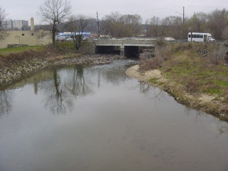
LOCATION.--Lat 38°57'09.2", long 76°57'54.5", Prince Georges County, MD, Hydrologic Unit 02070010,
   on right bank 300 ft downstream from bridge on Queens Chapel Road (State Highway 500), 0.8 mi downstream
   from Sligo Branch, 1.0 mi west of Hyattsville, and 1.6 mi upstream from confluence with Northeast Branch.
DRAINAGE AREA.--49.4 mi2.
PERIOD OF RECORD.--July 1938 to current year. Monthly discharge only for July 1938 published
   in WSP 1302.
REVISED RECORDS.--WSP 971: 1942(M). https://waterdata.usgs.gov/nwis/dv/?site_no=01651000: 2018.
https://waterdata.usgs.gov/nwis/uv/?site_no=01651000: 2013-2020.
GAGE.--Water-stage recorder and crest-stage gage.
   Prior to Oct. 22, 1938, nonrecording gage; Oct. 22, 1938 to Sept. 17, 1951, water-stage
   recorder; Sept. 17, 1951 to Aug. 29, 1952, nonrecording gage and crest-stage gage.
   Datum of gage is 16.35 ft above North American Vertical Datum of 1988. July 1938 to September 2012, at datum
   17.10 ft above National Geodetic Vertical Datum of 1929.
REMARKS.--Prior to June 1961, low flow regulated by storage at Burnt Mills Dam, 7.0 mi upstream from
   station. Inflow pumped from Patuxent River to augment water supply for Washington Suburban Sanitary
   District, August 1939 to August 1960. Small diversion since 1962 for irrigation of golf courses upstream
   from station. U.S. Geological Survey satellite data-collection platform at station. Water-quality records
   for some prior periods have been collected at this location.
EXTREMES FOR PERIOD OF RECORD.--Maximum discharge, 18,000 ft3/s, June 22, 1972, gage height, 14.47 ft;
   minimum discharge, 0.20 ft3/s, Sept. 11, 1966.
COOPERATION.--Funding for the operation of this station is provided by Prince George's County
   and the U.S. Geological Survey.
Summary of all available data for this site
Instantaneous-data availability statement