PROVISIONAL DATA SUBJECT TO REVISION
Click to hidestation-specific text
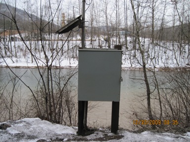
LOCATION.--Lat 39°28'44.3", long 79°03'49.6", Allegany County, MD, Hydrologic Unit 02070002,
   on left bank 0.3 mi downstream from Savage River, 0.4 mi northwest of Luke, and at mile 53.2.
PERIOD OF RECORD.--June 1899 to July 1906 (published as "at Piedmont, W. Va."), October 1949 to current year.
REVISIONS HISTORY.--WSP 192: 1899-1904. WSP 1432: 1905-06, drainage area at former site. WDR WV-97-1: Drainage area.
DRAINAGE AREA.--406 mi2.
GAGE.--Water-stage recorder and crest-stage gage. Datum of gage is 943.68 ft above North American Vertical
   Datum of 1988. June 27, 1899 to July 15, 1906, nonrecording gage at bridge, 1.1 mi downstream at gage datum
   about 35 ft lower. October 1949 to September 2008, recording gage on right bank, 400 ft upstream at same gage datum.
REMARKS.--Flow regulated prior to July 1981 by Stony River Reservoir, 45 mi upstream from station, since December 1950
   by Savage River Reservoir, 5 mi upstream from station (see station 01597490), and since July 1981 by Jennings
   Randolph Lake, 9 mi upstream from station (see station 01595790). Some regulation at low flow by West Virginia
   Pulp and Paper Company at site used 1899-1906. U.S. Army Corps of Engineers satellite data-collection platform at station.
EXTREMES FOR PERIOD OF RECORD.--Maximum discharge, 39,400 ft3/s, Oct. 15, 1954, gage height, 17.15 ft;
   minimum discharge, 6.0 ft3/s, Sep. 4, 1904.
EXTREMES OUTSIDE PERIOD OF RECORD.--Flood of March 29, 1924, reached a discharge of about 51,000 ft3/s.
COOPERATION.--Funding for the operation of this station is provided by the U.S. Army Corps of Engineers, Maryland
   Department of Natural Resources, Maryland Geological Survey and the U.S. Geological Survey Cooperative Water Program.
| Boating safety tips |
Summary of all available data for this site
Instantaneous-data availability statement

